Case Studies for Urban Digital Twins and 3D City Models
How cities, municipalities, and infrastructure operators use the solutions of Virtual City Systems in practice
Digital Twins in practice: How our customers work with 3D city models
The case studies by Virtual City Systems show how cities, municipalities, and infrastructure operators use Urban Digital Twins in practice.
The focus is not only on the technologies, but above all on the people who work with them: urban planners, geospatial experts, IT teams, and project managers in administrations and organizations. They use digital tools to make planning processes easier to understand and to communicate decisions transparently. Always with the aim of making data and processes as inclusive as possible and enabling decisions for future-oriented development with Digital Twins.
The following case studies provide insight into different projects, from digital urban planning to climate applications and infrastructure planning, and show the added value that Digital Twins create for administration, smart city units, and other organizations.
Wiesbaden
Smart City · Urban Digital Twin

Wiesbaden’s path to a Digital Twin
The state capital Wiesbaden is further developing its Urban Digital Twin as a modular smart city platform and, based on the VC Suite, integrates 3D city models, geospatial data, and specialized applications. It supports, among other things, municipal heat planning, mobility analyses, and urban measures for citizens.
Case Study Wiesbaden: Urban Digital Twin as a smart city platform
Helsinki
Automation · 3D City Model

Helsinki: Automating Urban 3D Data for Living Digital Twins
The City of Helsinki automates the updating of its 3D City Model. Changes in the 2D building database are detected every night and automatically transferred to the 3D City Database. This ensures that the Digital Twin remains continuously up to date and is available to planners and architects without delay.
Bremen
Digital Urban Planning · 3D Planning

Bremen: Pioneer of the Urban Digital Twin
The Free Hanseatic City of Bremen uses VC Planner as a central tool for digital urban planning. Planning scenarios can be visualized and analyzed directly in the 3D city model. The Digital Twin helps to present complex projects in an understandable way and to support well-informed decisions.
Rostock
Geodata Platform · Climate Strategy
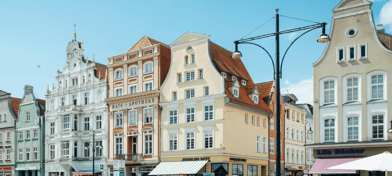
Smart Perspectives for a Self-Determined Digitalization
The Hanseatic and University City of Rostock is modernizing its geodata infrastructure with the VC Suite and is creating an open and modular platform for administration, climate strategy, and the public. One example is the VC Solar App. It enables the analysis of solar potential and CO₂ savings.
Case Study Rostock: Geodata Platform for Digital Urban Development
MITNETZ STROM
Infrastructure · Network Planning
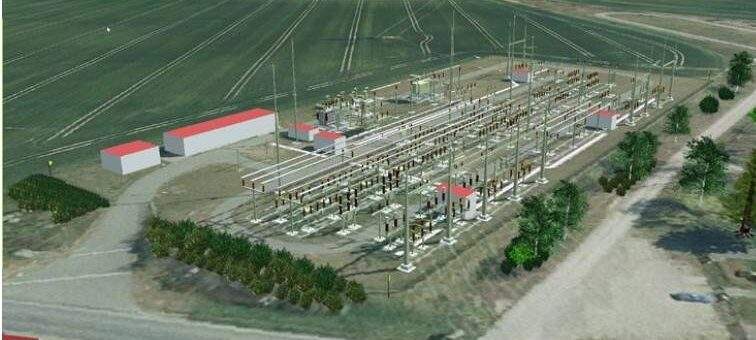
MITNETZ STROM: 3D as a New Level in Modern Network Planning
MITNETZ STROM uses a Digital Twin for the planning and analysis of its energy infrastructure. The platform integrates geospatial data, BIM models, and network planning data and enables the modeling of power lines and substations across the entire network area.
Case Study MITNETZ STROM: Digital Twin for Energy and Network Planning (German)
Frequently asked questions about Urban Digital Twins
Virtual City Systems develops solutions for Urban Digital Twins, 3D city models, as well as additional digital geospatial applications.
These are used, for example, in digital urban planning, climate analyses, and in the planning and analysis of infrastructure and energy networks.
The foundation of an Urban Digital Twin is a semantic 3D city model, often based on CityGML. Such models can be created, for example, from aerial imagery, laser scanning data, or existing geospatial data.
Using tools such as BuildingReconstruction (BRec), 3D building models are generated in LoD1 and LoD2. The models are then integrated into databases and platforms and form the basis for visualization, planning, and thematic analyses.
An Urban Digital Twin serves as a shared visualization and analysis layer for different municipal geospatial datasets. These include, for example, 3D building models, infrastructure information, environmental and sensor data, as well as open data sources.
In applications such as VC Map, this data can be visualized as thematic layers within the context of a 3D city model. This makes it possible to identify spatial relationships and to view data from different systems within the same context.
For use in an Urban Digital Twin, geospatial data from different sources must first be technically prepared and transformed into a consistent data model. This includes, for example, 3D city models in CityGML format, geospatial data from GIS systems, point clouds, or external data services.
Tools such as VC Publisher handle the conversion, structuring, and provision of this data. This allows city models and geospatial data to be efficiently used for various applications such as visualization, planning, or thematic analyses within the Digital Twin.
Digital Twins make it possible to integrate planning designs directly into the existing 3D city model. Building designs or infrastructure projects can be represented spatially and compared with the existing urban environment.
Tools such as VC Planner or VC Panorama support the visualization of planning variants, the import of designs, and the evaluation of scenarios within the context of the city model. This makes it possible to identify impacts on the cityscape, sightlines, or shading at an early stage.
3D city models make it possible to combine spatial data with environmental and energy data. Cities use these models, for example, for solar potential analyses, climate simulations, or shading analyses.
Applications such as VC Solar allow the calculation of solar potential for roofs and façades directly within the 3D model. Factors such as building structures, shading from neighboring buildings, or vegetation are taken into account.
Digital Twins enable a clear representation of planning and infrastructure projects in the spatial context of the city. Construction projects, development initiatives, or climate analyses can be visualized in the 3D model and made accessible to different target groups.
Web-based applications such as VC Map or VC Story support the structured presentation of content and help communicate planning information in a clear and understandable way.
Urban Digital Twins for informed decisions in cities and infrastructure projects
Would you like to learn how Digital Twins and 3D city models can be used in your organization? We would be happy to show you how to better connect complex geospatial data and gain new perspectives for planning, climate, and infrastructure.

“Behind every Digital Twin are people who want to better understand and further develop their city. It is precisely this collaboration between technology and municipal practice that makes these projects so compelling.”
Henry Willem Farr, Head of Sales at Virtual City Systems