What do we mean by a Digital Twin?
Urbanization and digitization and the associated increasing complexity in the design and management of our cities require new methods for networking the stakeholders. We see Digital Twins as the heart of smart cities and regions. The virtual representation of the city and region enables the linking of diverse systems and processes across domains and can make decisions more transparent, efficient and sustainable.
Digital Twins as a central visual platform facilitate communication within the administration and with citizens. By embedding planning projects in the 3D city model, future scenarios can be illustrated and environmental effects better understood. In addition, the integration of real-time data, for example with regard to traffic or climate, allows the pulse of the city to be measured in order to act promptly and with an overview.
Urban simulation brings the Digital Twin to life. It allows the systematic investigation of what-if scenarios and helps to quickly and reliably derive different options for action. Mobility concepts, climate events or mass events can be simulated in advance and displayed in virtual urban space. In urban space, the best possible forecasts are needed to identify potentials and assess dangers – simulations in the Digital Twin are the central instrument for this.
Use Cases
Citizen information system
Decision-makers are increasingly recognizing that a digital twin will be indispensable in the future as a universal and central 3D information system. The high information value, the good spatial readability and the associated diverse application possibilities make Digital Twins a valuable tool for a wide variety of issues. In this context, the active use of the city model is always future-oriented, because the more it is enriched with information and linked, the more versatile and valuable it becomes.
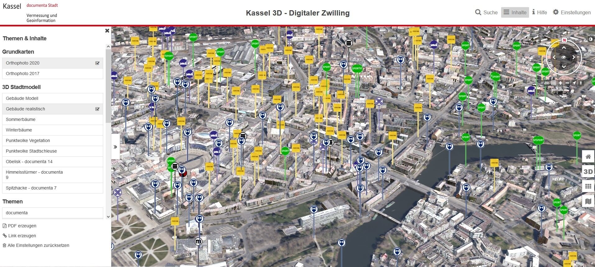
Cultural points of interest of the city of Kassel mapped in the Digital Twin. | Source: © City of Kassel
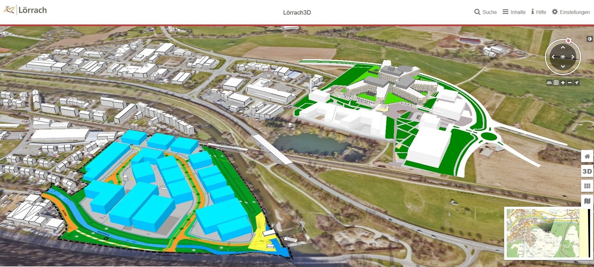
Central Hospital & Brombach East planning area draft in the 3D city model of the city of Lörrach | Source: © City of Lörrach
Digital urban planning
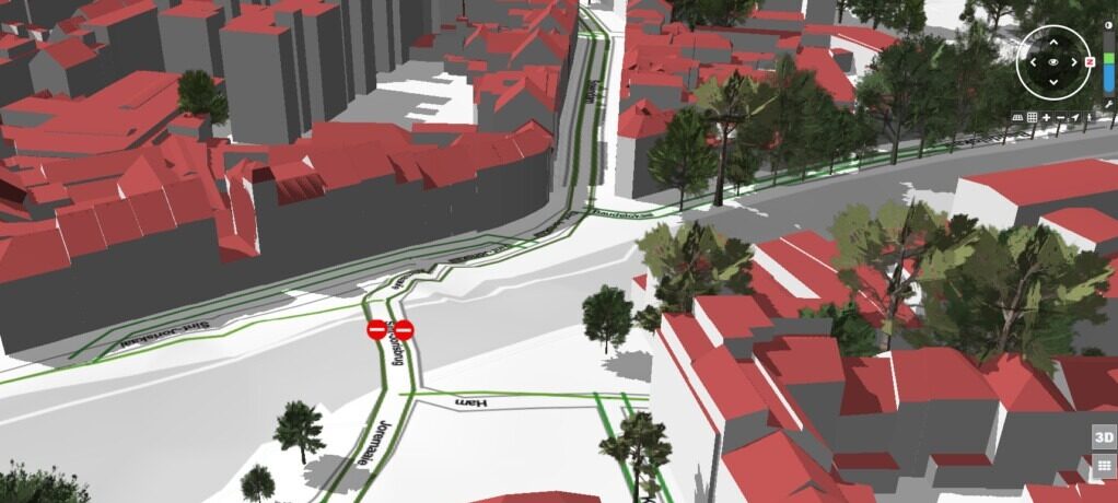
Digital urban planning in a 3D context brings numerous advantages. One example is the city of Lörrach on the border with Switzerland. Lörrach provides its citizens with a public 3D city model in which designs and plans for building objects are visualized in the context of the city’s surroundings. This makes it possible to see at an early stage how, for example, lines of sight change and plans fit into the surrounding built environment.
Integration of specialized data
The integration of various technical and infrastructure data is an essential part of the Digital Twin. For example, 3D geodata in the form of line cadastres, tree cadastres, high-voltage lines, wind turbines and BIM models can be mapped in the Digital Twin. This makes the Digital Twin applicable across all disciplines. The applications of the cities of Bremen (trees, high-voltage power lines, wind turbines) and Rotterdam (underground power line cadastre) are impressive examples of this.
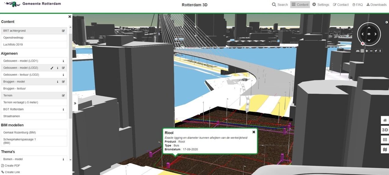
Transparent terrain showing underground pipeline cadastre in the Digital Twin of the city of Rotterdam | Source: © City of Rotterdam
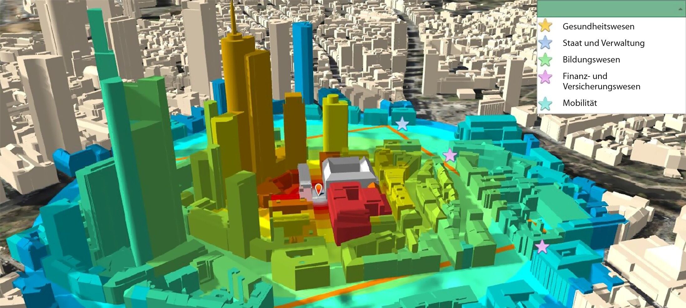
Visualization of the different danger zones when bombs are detonated including fragmentation flight and shock wave in the 3D city model | Source: © City of Frankfurt
Urban simulation
Urban space is sensitive and complex. Therefore, it needs the best possible predictions to identify potentials or assess hazards. Our urban simulation solutions couples 3D city models with numerical simulations and analyses.
Mobility
Sustainable mobility concepts and traffic scenarios can be researched, simulated and analyzed in the Digital Twin. A virtual test field served as the basis for the development of automated and connected driving in the SAVe research project.
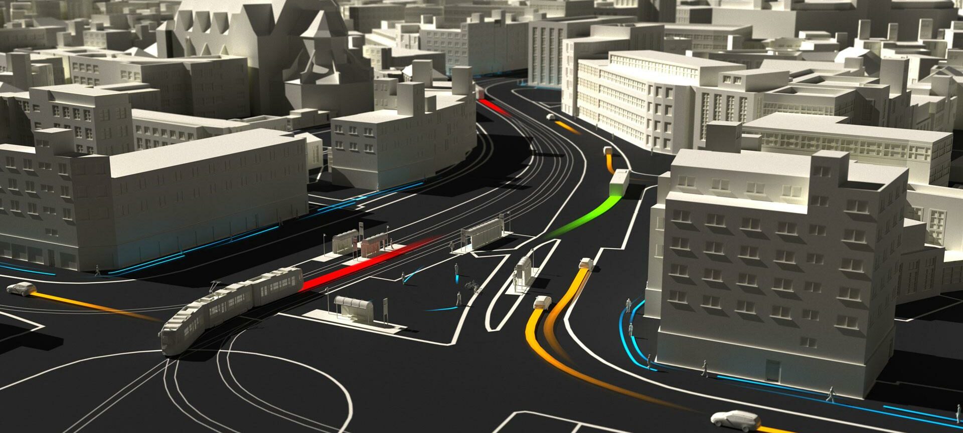
Traffic simulation in the 3D city model for the development of automated and connected driving | Source: © SAVe research project
Integration of IoT sensor technology for real-time measurement of traffic flows in the Digital Twin of the city of Ghent | Source: © City of Ghent
IoT
The DUET (Digital Urban European Twins) research project demonstrates the benefits of IoT sensing and processing of big open data sources through cloud and high-performance computing in urban governance. As part of the EU Horizon 2020 project, various applications are being developed and tested in the Flanders region (Belgium) and in the cities of Athens (Greece) and Pilsen (Czech Republic).
Products
VC Blastprotect
Simulation of detonation scenarios with previously unattained
accuracy and speed.
VC Publisher
Building a digital city model can be so easy – the publisher convinces with intuitiveness and performance.
VC View
Turnkey web application for visualization of geodata in all dimensions.
VC Planner
Create and integrate designs in the context of the surrounding development – quickly and easily with just one software solution.