BuildingReconstruction
CityGML builder
Automatically turn digital height data into comprehensive
3D city models in CityGML and Esri 3D shape files.
Automated reconstruction of 3D building models
in just minutes
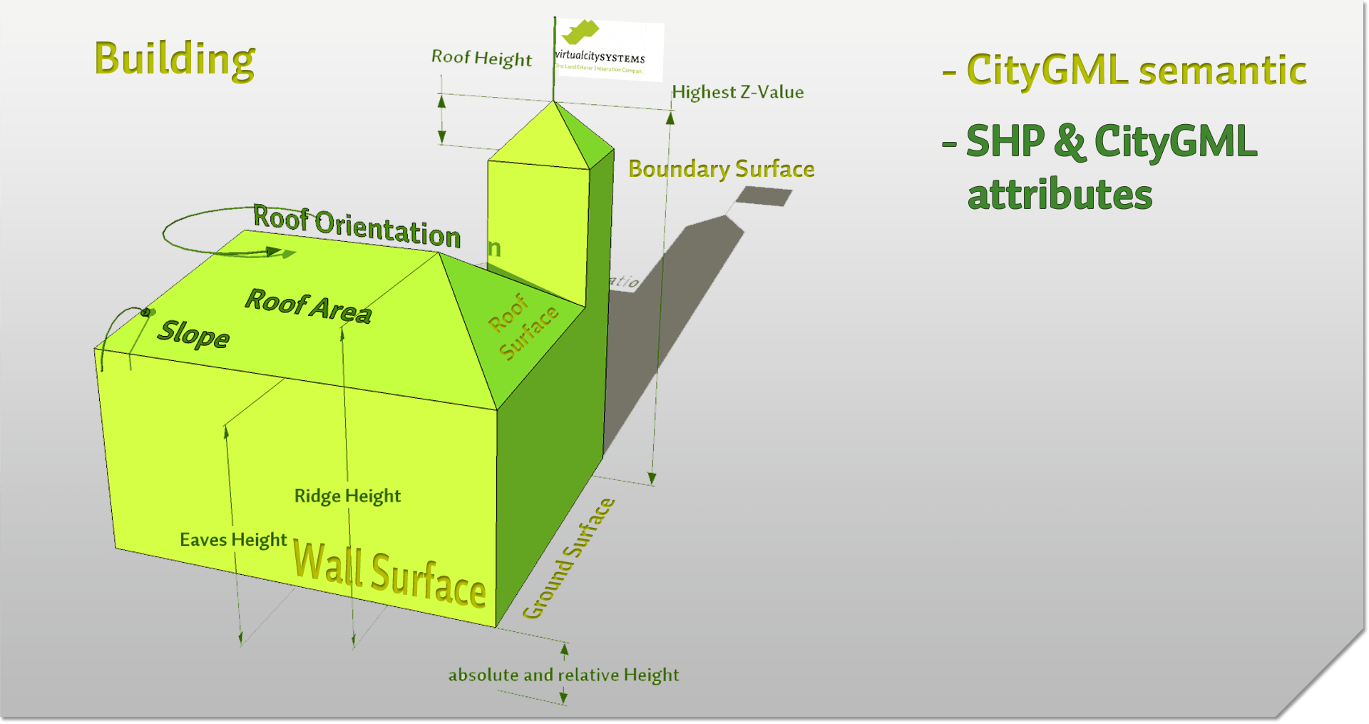
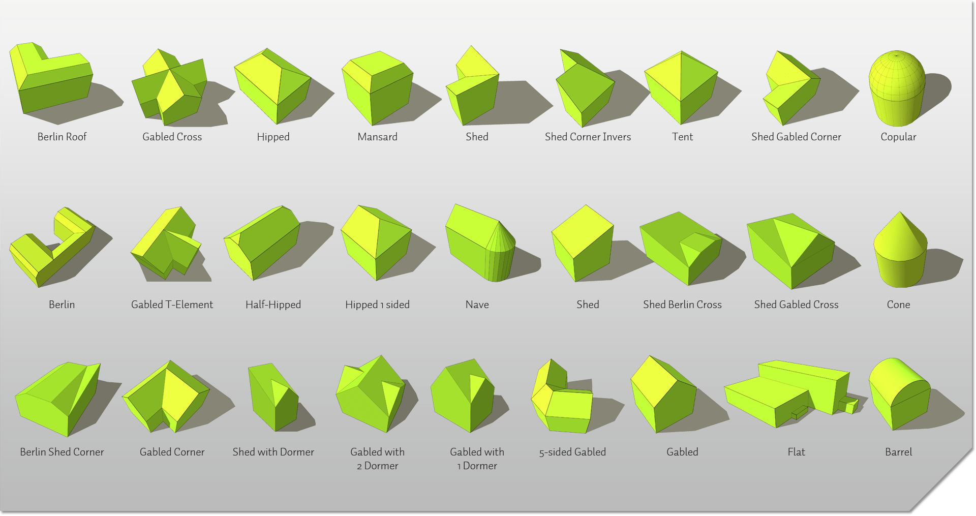
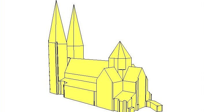
BuildingReconstruction generates 3D building models in LoD1 and LoD2. This makes it possible to create LoD2 buildings with any common roof shape.
Say goodbye to manual photogrammetric analysis: Roofs are automatically identified in digital surface models based on a predefined library of typical roof shapes.
BuildingReconstruction creates accurate building models with a high degree of reliability. It’s possible to post-process any building manually, as well.
The software’s internal editing tools make applying any necessary corrections and refinements to models a quick and easy process.
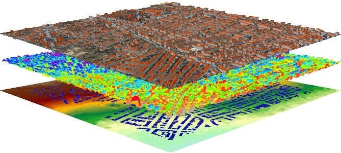
All it takes is four common input files
- Building plans (Esri shape file)
- Digital surface model (ASCII grid or XYZ point cloud)
- Digital terrain model (ASCII grid or XYZ point cloud)
- Digital orthophoto (georeferenced JPEG)
Hight-quality results
Users receive comprehensive, topologically accurate files that are true to the plans in question (right down to the roof shapes) in CityGML or Esri 3D shape format.
CityGML-building
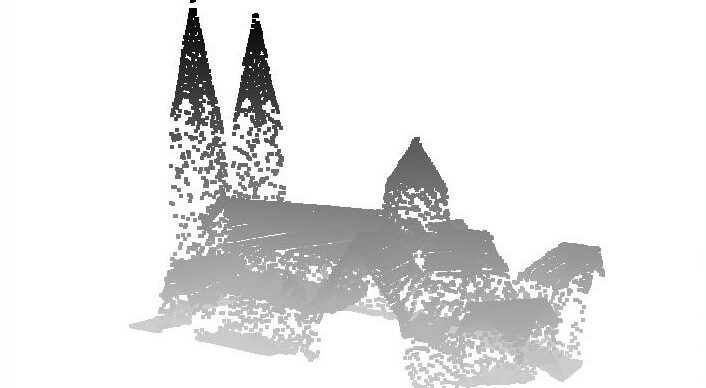
Pointcloud-building
Other features our customers love
- Large-area reconstruction of LoD1 and LoD2 building models
- Direct exporting into CityGML 2.0 with flexible attribute mapping
- High automatic detection rate for typical roof shapes
- Convenient editing tools that make manual post-processing easy
- Automatic attribute calculation for enriching models
- Offers a high level of geometric accuracy by ensuring plan fidelity
- Building models are then suitable for texturing with oblique aerial images