digital views. real perspectives.
since 2005.
A straightforward solution for complex challenges –
new and innovative ways with Digital Twins.
Since 2005, we have supported cities, municipalities and infrastructure operators in making complex interdependencies visible and usable. Always with the aim of designing data and processes to be as inclusive as possible – and enabling decisions for future-oriented development with digital twins.
Lights, camera, action! Get to know us.
Shaping the future begins with an idea. Ours started in 2005.
When we were founded in Chemnitz in 2005, the concept of digital city models was still in its infancy. Today, Digital Twins are an integral part of modern urban planning – and Virtual City Systems is among the leading providers in this field.
What drives us? Technical depth, a passion for innovation, and the conviction that good urban planning is built on reliable, open data. Our VC Story shows how ideas evolve into solutions.
3D City Models
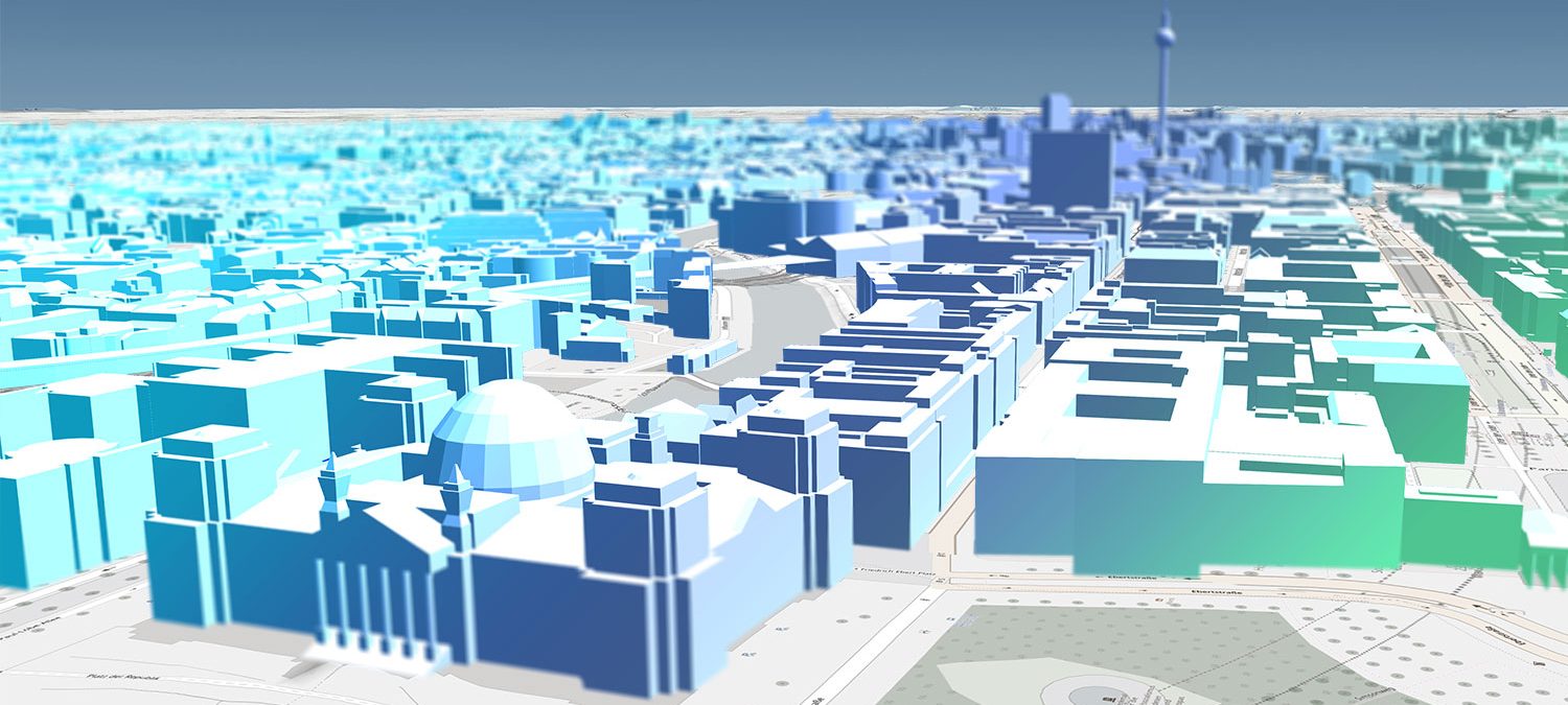
A growing number of decision makers are realizing that 3D city models will soon be an indispensable central information system that virtually anyone can access. The high-quality
information and solid spatial visibility they offer – and the diverse range of uses they support as a result – make such models a valuable tool for addressing a wide variety of issues.
Digital Urban Planning
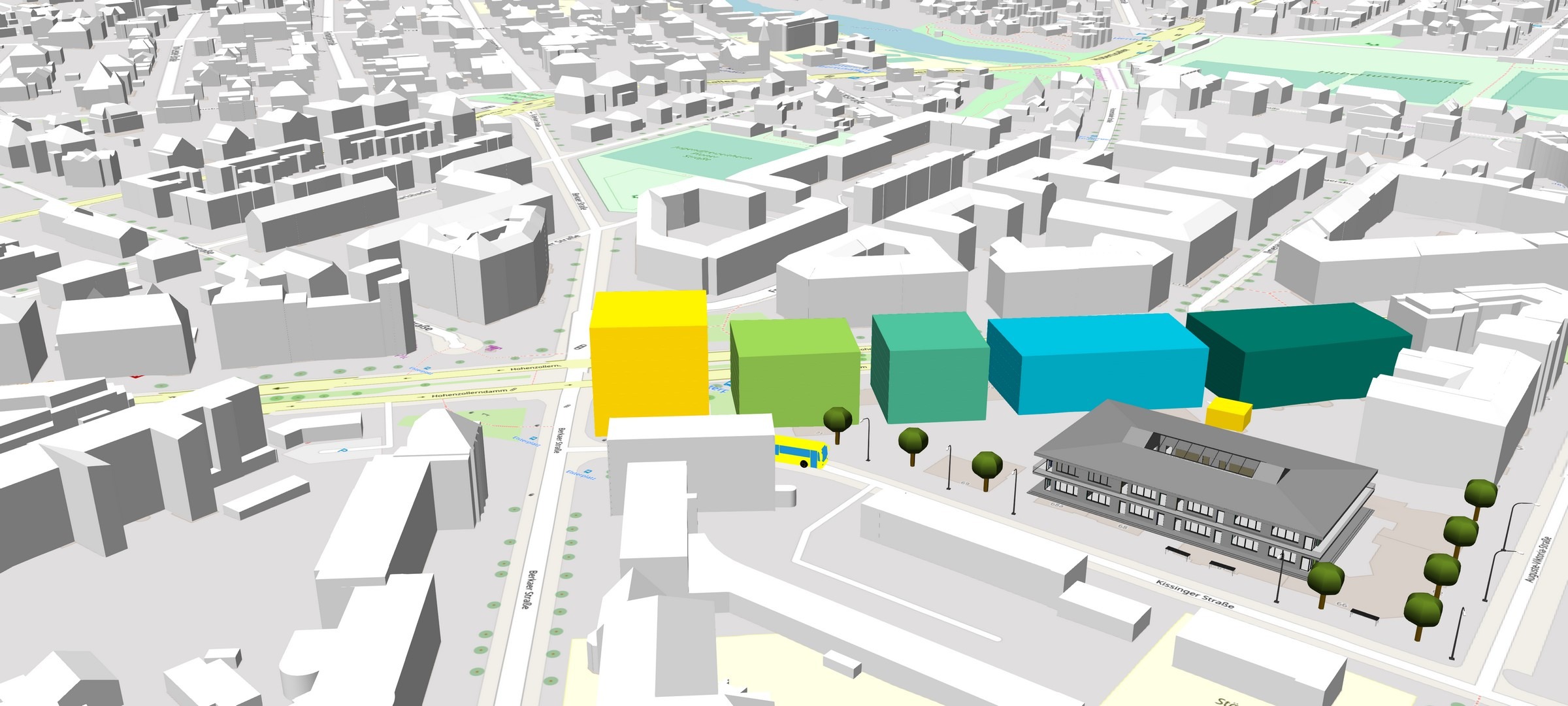
The field of urban planning is subject to a good deal of give-and-take with regard to the general public interest. During planning processes, interested citizens and the people involved in such projects need to be able to understand the underlying plans and follow along as they take shape. Here, it’s important to present and pass on information regarding the backgrounds, challenges, and visions pertaining to urban planning projects in a comprehensible way.
Urban Simulation
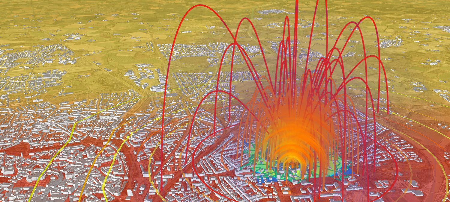
Simulation of the spread of blast waves and shrapnel caused by unexploded aerial bombs from World War II while factoring in surrounding structures with unprecedented accuracy and speed. Along with adjustments in existing structures, the solution supports the modeling of specific situations in which such ordnance is discovered and can incorporate further objects (e.g. temporary container walls) into its simulations.
News from our Blog
VC Story now available with Editor
The new editor in VC Story enables the graphical creation and maintenance of VC Stories directly within the App Configurator. This allows map stories to be created, structured, and published without any programming.
VCS User Conference 2026 in Berlin
Our yearly exclusive user meeting for customers and partners will be taking place in Berlin on September 30 and October 1, 2026. We are already looking forward to this valuable event.
INTERGEO 2026 in Munich
Visit us at this year’s INTERGEO 2026, September 15–17, in Hall C6 at the “Messe München” Munich Trade Fair Centre.
Some of our customers


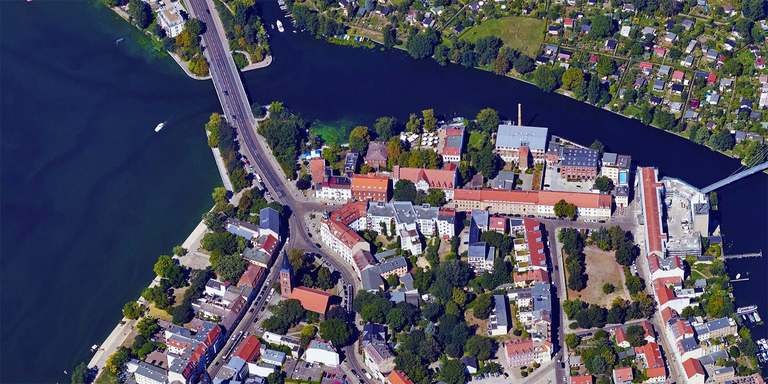
Oblique Aerial Images
Today, high-resolution oblique aerial images are an important tool used by many municipal and district administrations. They provide an excellent foundation for analyzing urban structures and ascertaining changes in both urban and rural settings.
“I dreamed as a young architect that one day we would use tools so we can do more alternatives, create more ideas, and show them more clearly. And now we are very close to this dream. Virtual City Systems accompanies us on this path for many years with their innovative technology and as a thought leader.”
Jarmo Suomisto, Project Manager, Helsinki 3D+,
City Executive Office, City of Helsinki

3D GeodataInfrastructure
One of the main challenges lies in integrating spatial information into administrative, planning, and decision-making processes. Here, 3D geodata has to be refined and managed in a holistic system that enables users to get the
absolute most out of it.
„We want to improve the lives of our citizens, create economic opportunities and revitalize the urban community. With our “Seeing and Understanding Bremen” concept, we are developing the city’s digital twin and linking it with geospatial data. The solutions from Virtual City Systems help us to work more efficient and transparent. This enables us to better analyze and respond to urban design, social, economic and ecological changes.“
Sarah Tesmer, Head of Department, State Office GeoInformation Bremen, Free Hanseatic City of Bremen