VC MapVC Story
Vienna shows how digital urban planning brings cycling to life: with „Radwege3D“
With the VC Story application, Virtual City Systems makes the city of Vienna’s cycle path network visible as an interactive 3D map – thereby supporting the mobility transition.
Interactive, immersive, innovative: cycling through Vienna can now be experienced digitally
How does it feel to cycle on Vienna’s new mega cycle highway – even before the bike is ready? This is exactly what the „Radwege3D“ digital application, developed by the city of Vienna in collaboration with Virtual City Systems, makes possible. The solution is based on VC Story, a platform for immersive 3D visualizations that can be used to communicate complex urban development projects in a clear and interactive way.
In the app, users can move along real routes, explore projects that have already been completed or are planned, and learn how the city is investing in sustainable mobility. Vienna is thus demonstrating how digital urban planning can inform and encourage participation at the same time.
Sustainability meets digitalization: €130 million for cycling in Vienna
From 2021 to 2025, the city of Vienna will invest around €130 million in cycling infrastructure. The aim is to create safe connections, close gaps, and strengthen cycling as a climate-friendly alternative.
With the VC Story, Vienna wants to not only document the measures, but also make them tangible – for example, through a virtual ride on the new mega-cycle highway, which will connect the city center with Donaustadt from fall 2024.
“CAD design data is difficult to use in citizen communication. Derived 3D data, immersion in a virtual world, makes urban planning easy for everyone to understand. With „Radwege3D“, we are setting new standards in the communication of infrastructure projects. Citizens can explore planned and completed projects and see where the city of Vienna is investing specifically in cycling and unsealing – this creates transparency and promotes acceptance of sustainable mobility.”
VC Story – the technology behind the animated bike tour
Let’s take a closer look at the technical heart of the project: VC Story from Virtual City Systems uses the Flights plugin to precisely control camera movements along routes in the VC Map. One highlight is the synchronized ride of an animated cyclist along the bike highway – a feature that was implemented using CZML data.
“The challenge was to precisely coordinate the camera flight and the movement of the animated cyclist – despite changing viewing angles and viewing distances.”
Another detail was also specifically optimized: the representation of trees. In order to achieve a natural appearance of the vegetation, a number of adjustments were necessary in the modeling and conversion of the vegetation data for the web application.
“Optimizing the leaf textures in the model and preparing the data for streaming was a challenge, as many factors in the process influence each other and have to interact.”
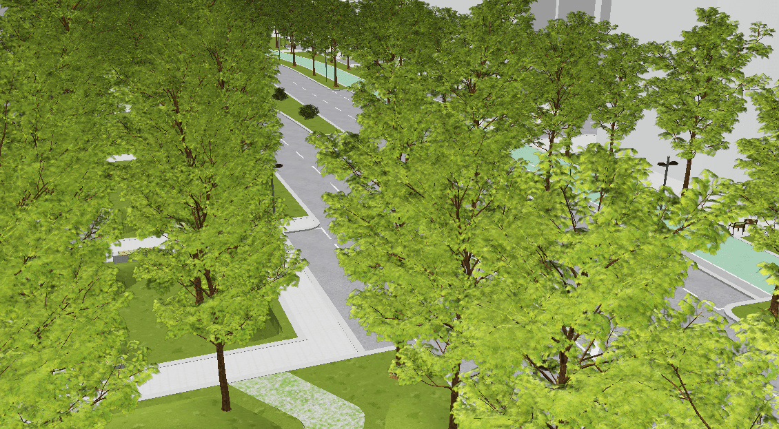
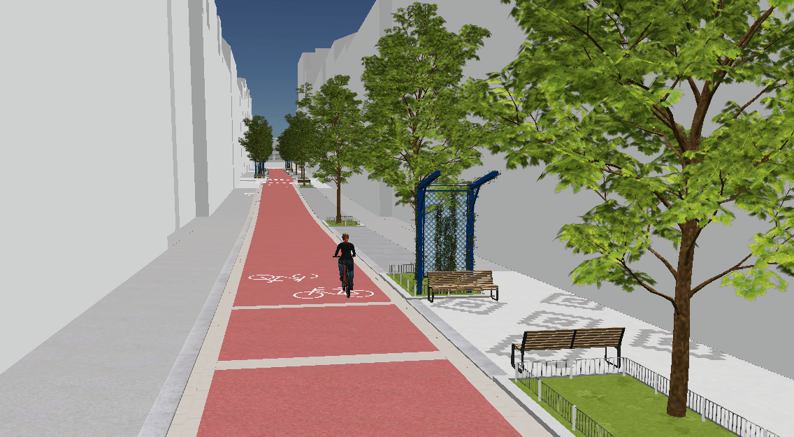
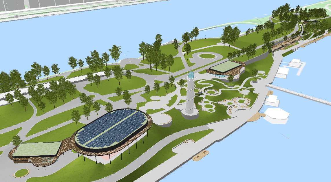
Figures 1 to 3: Whether close up, directly on the bike path, or viewed from above on the Danube Island, the textures of the trees fit harmoniously into the picture in every (zoom) view.
Agile collaboration between Virtual City Systems and the City of Vienna
The project was implemented in an iterative, collaborative process in which the City of Vienna was able to continuously contribute its own ideas and adaptation requests, and solutions were developed jointly.
The application was initially set up by Virtual City Systems and then handed over to the Vienna City Surveying team. The latter took over the HTML code of the VC Story, finalized the content, and independently optimized the story section for mobile devices. In addition, content and routes can be maintained flexibly and independently of the City of Vienna in the future.
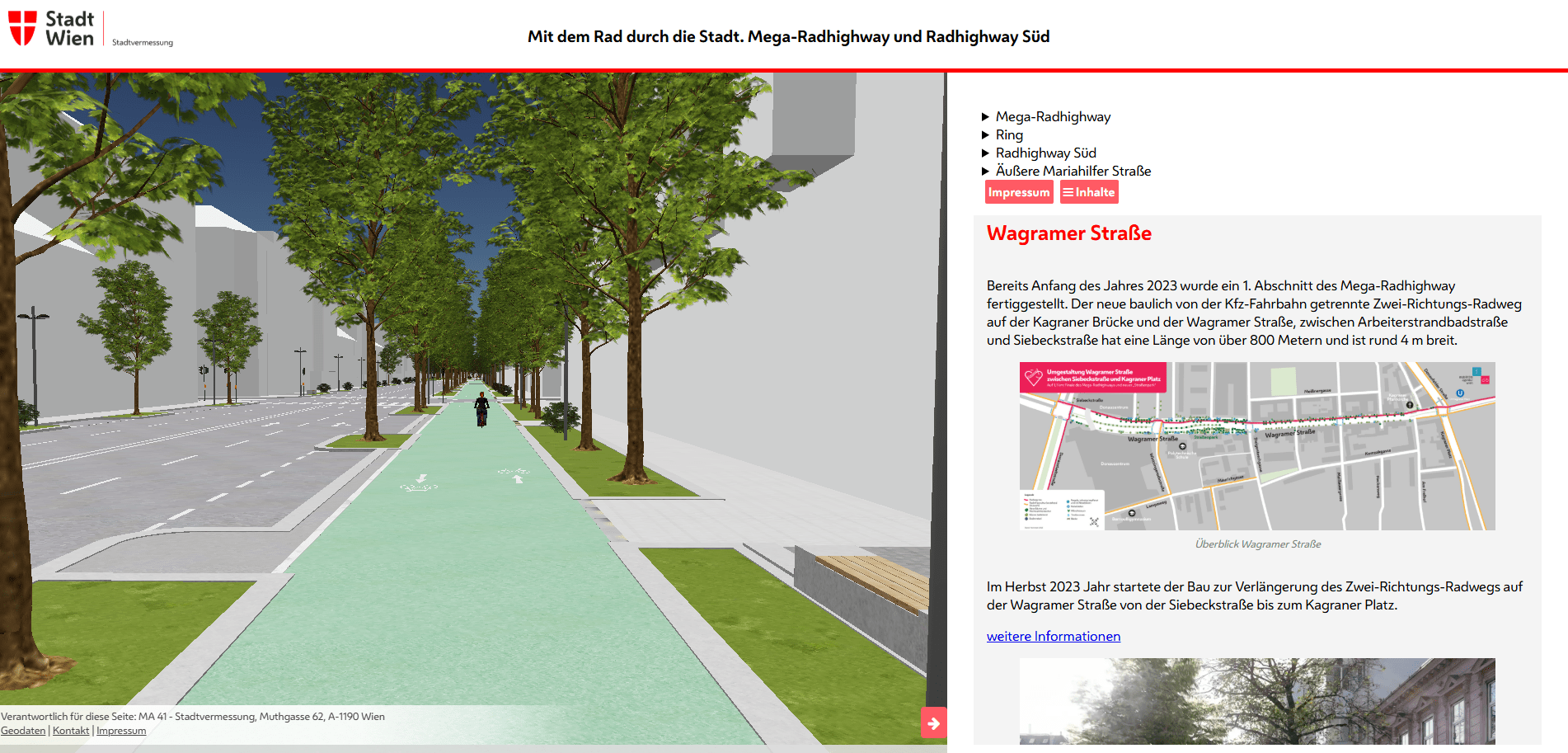
Image: Mega-Radhighway and Radhighway Süd, as central traffic axes, are the focus of VC Story. In addition to the 3D representation, there are explanations of the individual sections and projects, 2D map material, photos, and further links.
The result: a visible and tangible mobility revolution for Vienna
The finished application brings Vienna’s cycle path network to life digitally – on several levels:
- Planning presented in an understandable way: citizens can immerse themselves virtually in the cycle routes shown
- Transparency about where the city is investing in sustainable mobility and unsealing
- Visualization of infrastructure for political and planning communication
Here in the video you can see the VC Story in action – including a synchronized cyclist, camera flight, and tree textures in the 3D city model.
Inspiration: The VC Story is also ideal for other cities and scenarios
The underlying technology – in particular the combination of camera flight, synchronized model, and 3D city model – is universally applicable. Whether for pedestrian traffic, public transport, or logistics: Virtual City Systems opens up new ways to present infrastructure in an emotional and understandable way with VC Story.
“The solution can be adapted for any city or industry where routes and movements need to be clearly visualized.”
Experience it now: VC Story for your digital urban planning
Would you like to know how digital 3D visualization can support your urban planning? Or do you already have a specific project in mind? Contact us – the Virtual City Systems team will be happy to show you how VC Story can also be effective in your municipality.