3D City ModelClimateUrban SimulationWater
City of Wiesbaden: 3D visualization of water level layers
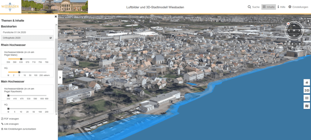
Visualization of water level data for the Rhine and the Main estuary
Virtual City Systems is pleased to announce a development in water level monitoring for the Wiesbaden area. In cooperation with the Federal Institute of Hydrology (BfG) and the Civil Engineering and Surveying Office of the City of Wiesbaden, our team has developed a 3D visualization of water level data for the Rhine and the Main estuary.
Previously, such data was only available in two dimensions, which limited the accuracy and precision of flood estimation in the region. However, with the new application, users can easily and intuitively visualize the water levels in 3D and get a more detailed and comprehensive picture of the situation.
Because the application provides a more accurate understanding of water levels in the region, it can help identify potentially vulnerable floodplains, providing important information for disaster preparedness planning and emergency management. This is especially important given the increasing frequency and severity of extreme weather events, which have made flood management a top priority for many communities.
By working closely with BfG and the Civil Engineering and Surveying Department of the City of Wiesbaden, we were able to develop an application that truly meets the needs of the community. We believe this type of collaboration is essential to addressing complex challenges like flood management, and we look forward to continuing to work with our partners to find innovative solutions to these pressing issues.
We are excited to see the impact it will have in the Wiesbaden region and hope it will serve as a model for other communities facing similar challenges.
The application can be found here:
