New ReleaseVC XPlan
VC XPlan | New plugin available now
With VC XPlan, zoning plans are transformed into clear, easy-to-understand 3D models – directly within the VC Map.
Zoning plans form the foundation of urban development, yet they are often difficult to read and communicate. With the new VC XPlan, a plugin for VC Map 6, XPlanung-compliant zoning plans can be searched, filtered, and integrated directly into the map application.
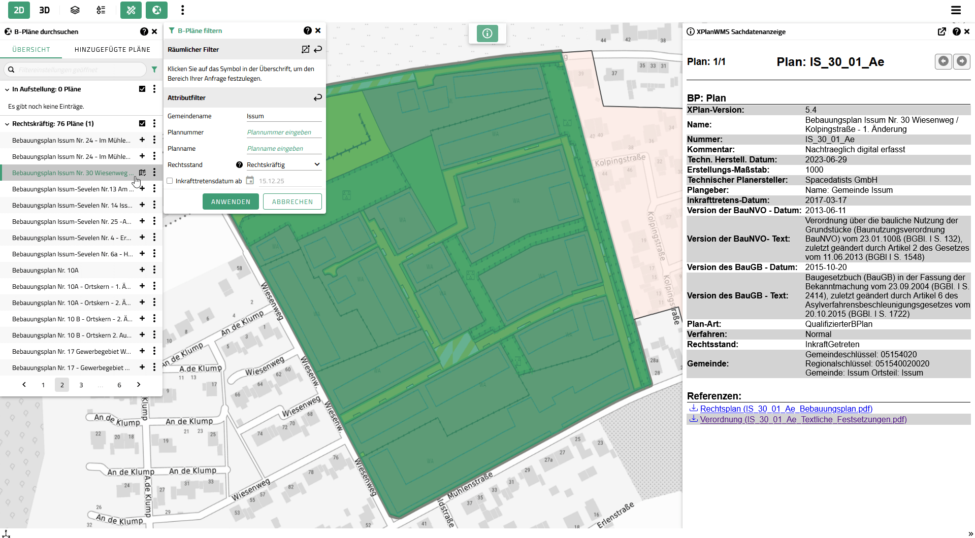
This makes planning content and regulations transparent, easy to understand, and clearly visualized – especially in combination with existing 3D city models. In addition, related attribute data can be accessed and linked documents can be downloaded directly from within the application.
-
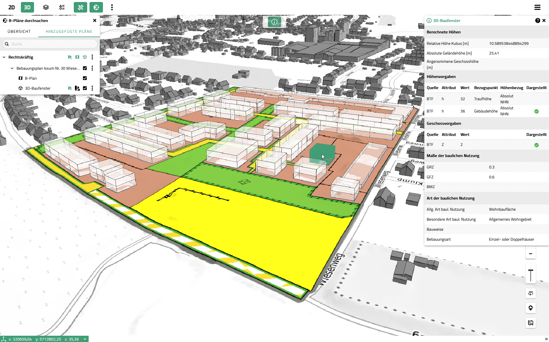
Dynamic search and integration of 2D plans > visualization of 2D plans within the 2D/3D map
-
Hiding of existing buildings within the plan’s area of validity
-
Automated 3D visualization of building plots
-
Rule set based on XPlanGML elements
-
No pre-processing required, dynamic styling
-
-
Support for xPlanBox as a backend via WMS/WFS services > connection of additional XPlan-compliant backends possible
Zoning plan in 3D: automatically generated building plots from XPlan-compliant data in the VC Map
Dynamic search and integration of zoning plans, including metadata display for the selected plan
Funding of the development of VC XPlan: The commission from the District of Kleve emerged from a parliamentary funding project of the Federal Ministry for Housing, Urban Development and Building. The XPlan plugin was developed as one of three components of the model project “Building Potential Register from Fully Vectorized XPlanung Data in 3D.”