Digital TwinVC Map
Digital Future in the District of Hof: How hoferLand.digital Is Building a New System Landscape
hoferLand.digital demonstrates how data-driven decision-making, visualization, and participation can be implemented successfully in rural areas. Beyond the technical innovation, it represents a structural shift in municipal governance—a replicable model for communities with the motivation, resources, political will, and openness to embrace digital transformation.
A New Era of Digital Innovation Begins
On October 27, 2025, the District of Hof launched one of the most ambitious smart city initiatives in rural Germany. With the opening of the “InnovationsRAUM Hofer Land” and the launch of the digital platform hoferland-digital.de , a networked, scalable system was introduced to make digitalization accessible across the board—for citizens, administration, and politics. The symbolic start was marked by the presence of Federal Minister Verena Hubertz.
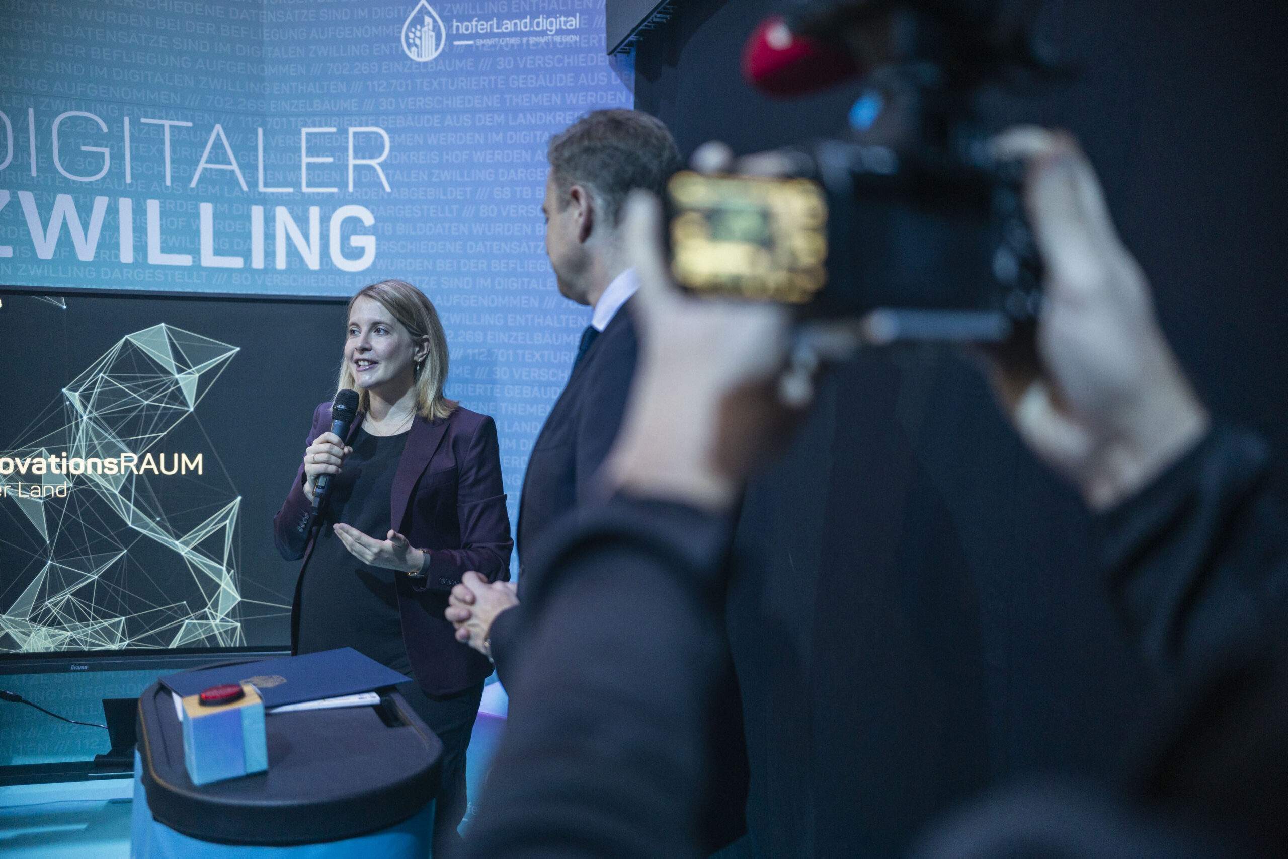
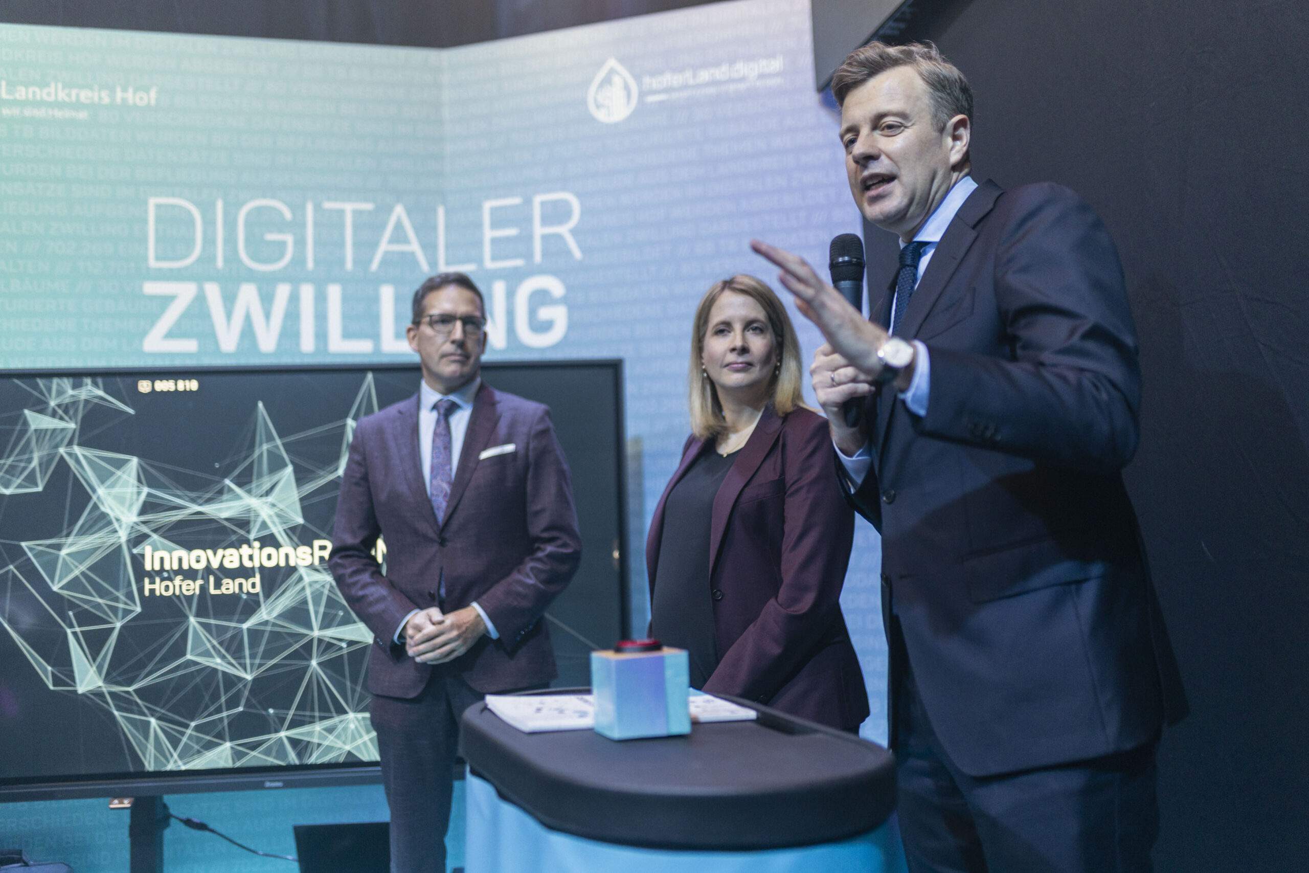
Figures 1 & 2: Federal Minister Verena Hubertz, with Oliver Bär, District Administrator of Hof, and Michael Abraham, Mayor of the City of Rehau, at the official opening of the InnovationsRAUM Hofer Land. Coverage of the event is available via Frankenschau aktuell, 27.10.2025.
The Technical Foundation: A System Landscape Built by Three Strong Partners
The hoferLand.digital platform is built on three tightly integrated components:
RIWA assumed overall technical responsibility as general contractor. The company developed the web mapping platform, integrated local cadastral and specialist data, and created user-friendly interfaces. High-resolution data was collected via comprehensive aerial and terrestrial surveys, forming the foundation for the Digital Twin and subsequent visualizations. More on RIWA in the Flipbook.
DKSR (Daten-Kompetenzzentrum Städte und Regionen) provided CIVORA, a modular smart city data platform that acts as a central hub for data, maps, and applications. CIVORA integrates administrative, sensor, and open data into a unified infrastructure.
Virtual City Systems (VCS) provided the geo-component: the Digital Twin of Hofer Land is based on VC Map, which visualizes sensor data, 3D models, and GIS data in real time.
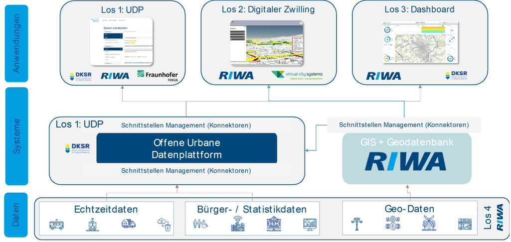
Figure 3: A new system landscape forms the basis of hoferland-digital.de in Hofer Land.
The collaboration between these partners has created an open, scalable, and interoperable system—a blueprint for other municipalities. More on this in our Business Geomatics article 2/25.
Open and Local Data as a Common Basis
At the heart of hoferLand.digital lies the intelligent integration of open data sources and locally acquired geospatial data. Aerial and terrestrial surveys provide the precise foundation for the Digital Twin, while publicly available open data—such as from open.bydata.de or BayernCloud Tourismus—adds specialist and environmental information.
The result is a unified, transparent data space that avoids redundancy, enables reuse, and benefits administration, research, and citizens alike. Through CIVORA and VC Map, both data types are seamlessly integrated and visualized in dashboards, maps, and applications.
VC Map: Geoplatform as an Integrative Component
VC Map serves as the central geo-application of the entire system. Fully embedded in CIVORA, it enables interactive visualization of spatial data—from development plans and sensor readings to real-time services.
Features such as theme map selection, the DynamicLayer plugin for external catalog integration, and support for LoRaWAN-based sensor data demonstrate the platform’s flexibility and openness. LoRaWAN is a low-power wireless network that enables long-range data transmission.
Thanks to its support for open standards (CityGML, WMS/WMTS, GeoJSON, SensorThings API), VC Map integrates easily into existing municipal IT systems. This makes it a reliable tool for both operational use cases (e.g., solar potential analysis, flood risk mapping) and strategic planning processes.
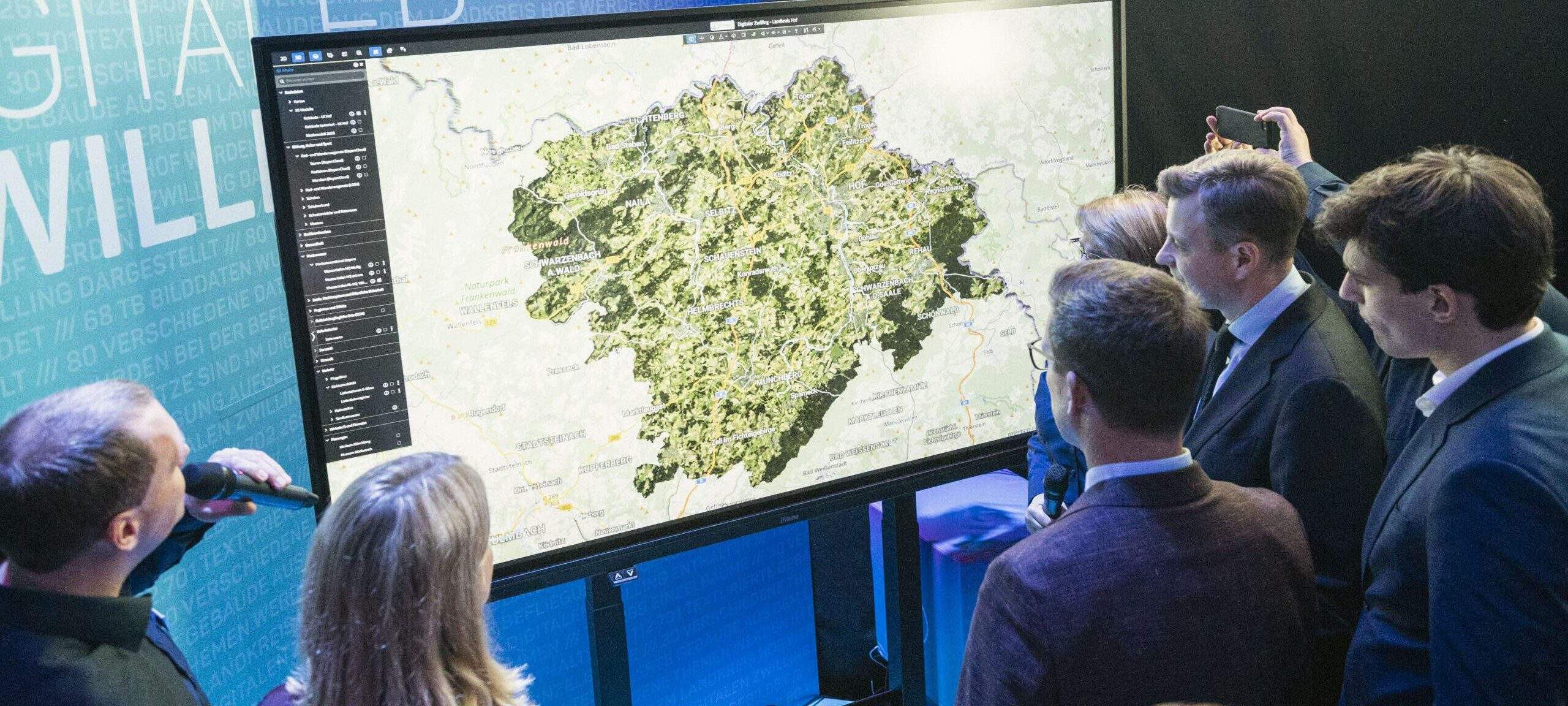
Figure 4: Citizens, city councils, and administrative staff can interact with the Digital Twin based on VC Map.
InnovationsRAUM Hofer Land: Making Digitalization Tangible
Visitors can explore digital innovation at four interactive stations:
- Virtual Reality (VR): Digital energy planning and time travel to historical Mödlareuth
- Dashboards & Data Visualizations: Real-time data on demographics, energy, and mobility
- Sensor Technology & LoRaWAN: Ice detection, water level monitoring, and smart infrastructure
- Digital Twin: Use cases in urban planning, flood risks, and solar energy
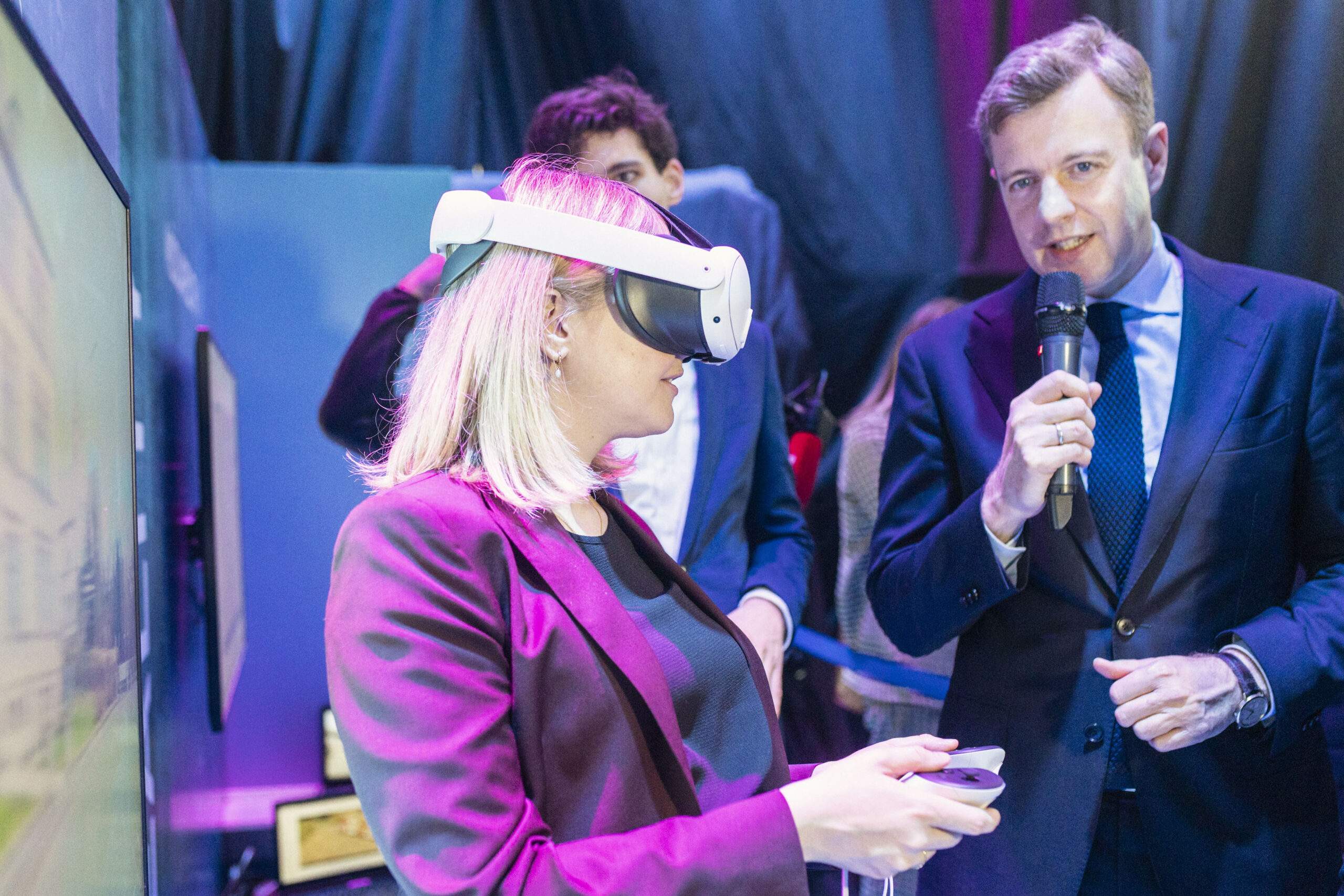
Figures 5 & 6: Federal Minister Verena Hubertz experiences VR technology—a tangible example of digitalization in action.
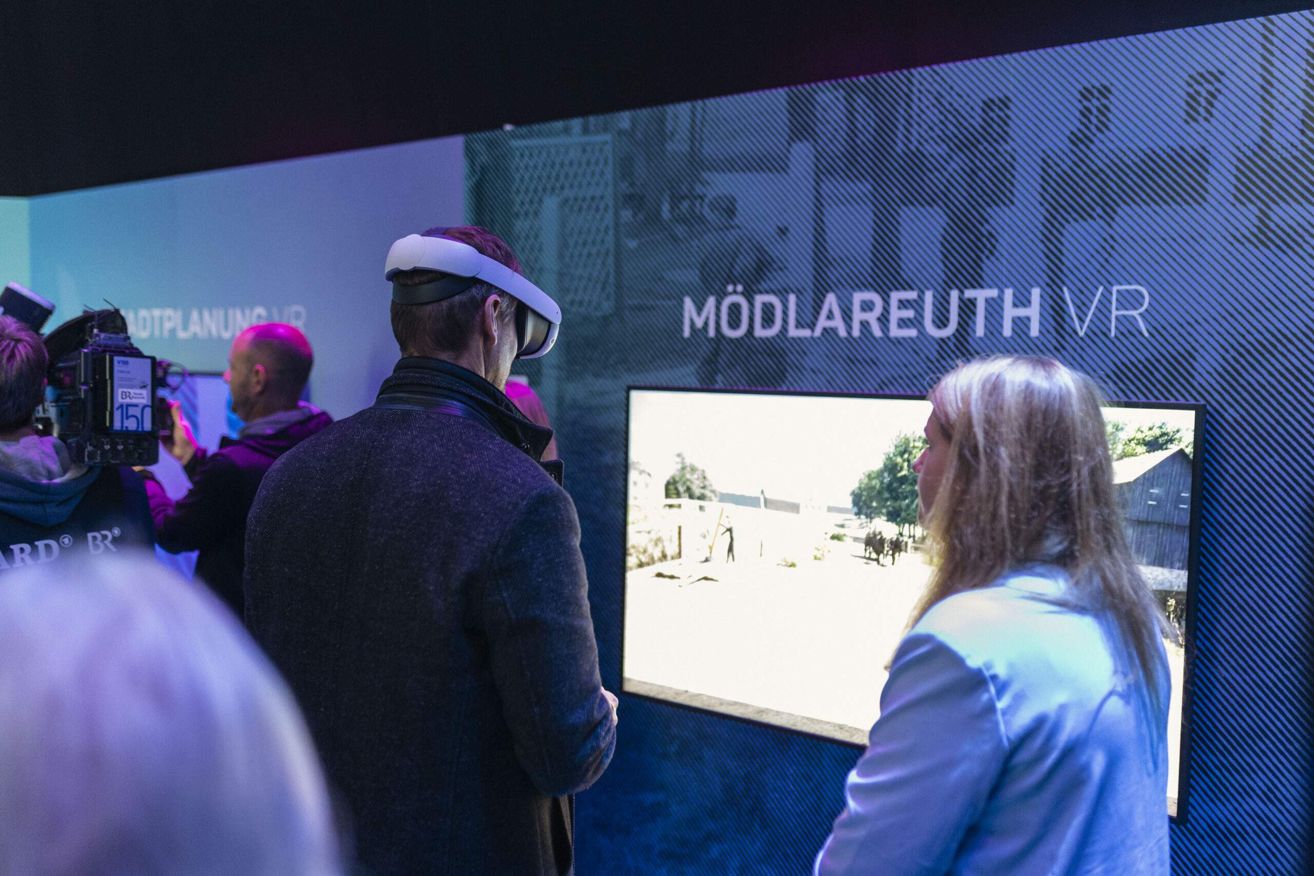
Mödlareuth – “Little Berlin” in Hofer Land
Divided for decades by a wall, Mödlareuth was split between Bavaria (FRG) and Thuringia (GDR), making it a unique symbol of Germany’s divided history.
Within the hoferLand.digital project, this past is made virtually accessible through 3D models and VR technology—an impressive example of digital history education.
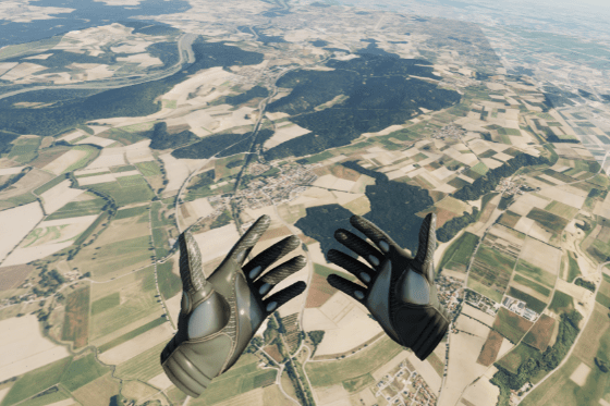
Figure 7: Mödlareuth as a VR experience. A modern way to preserve and convey history.
A Central Platform for Data Access and Collaboration
hoferland-digital.de serves as a central portal, bundling applications and data spaces for:
- Citizens: e.g., solar cadastre, VR experiences
- Administration: data visualizations, simulations, analysis
- Political bodies: data-driven decision-making tools
- Emergency services (e.g., police, fire department, medical services): access to security-relevant geodata
All 27 municipalities in the region work with the same data infrastructure—boosting both digital participation and intermunicipal cooperation.
Real-World Use Cases with Tangible Benefits
The following use cases are already live, with more planned:
- Fire water reservoir monitoring
- Flexible on-demand shuttle systems
- Barrier-free route planning
- Solar potential analysis
- Flood hazard maps
One particularly practical example: hunting district boundaries are stored in the system. In the event of a wildlife accident, police can immediately identify the responsible district—a feature already proving valuable in emergency response.
What’s Next: Project Milestones Through 2027
The implementation phase will continue through 2027, with planned developments including:
- Expansion of VR and AR applications (e.g., Unreal Engine, mobile AR apps)
- Broader use of sensor technologies (e.g., traffic flow, environmental monitoring)
- Integration of additional specialist data (e.g., land use plans, environmental maps)
The project aligns with DIN SPEC 91607 for Digital Twins in municipalities—solidifying its role as a national pioneer.
“hoferLand.digital stands out because the Smart City team has stepped beyond bureaucratic routines to integrate existing systems and datasets into entirely new administrative solutions.”
Scalable and Transferable: What Other Municipalities Can Learn
hoferLand.digital is scalable and transferable. Key success factors include:
- Open standards (open source, open APIs)
- Modular architecture (System-of-Systems)
- Use cases with clear, practical value
- Intermunicipal collaboration
The platform allows individual components—such as the Digital Twin or dashboards—to be used independently or integrated into existing infrastructures.
How to Get Started: Recommendations for Municipalities
Municipalities aiming to follow a similar path should:
- Define a clear digital strategy
- Explore opportunities for intermunicipal cooperation
- Prioritize open standards from the outset
- Choose experienced partners with municipal expertise
- Take advantage of relevant funding programs (e.g., MPSC)
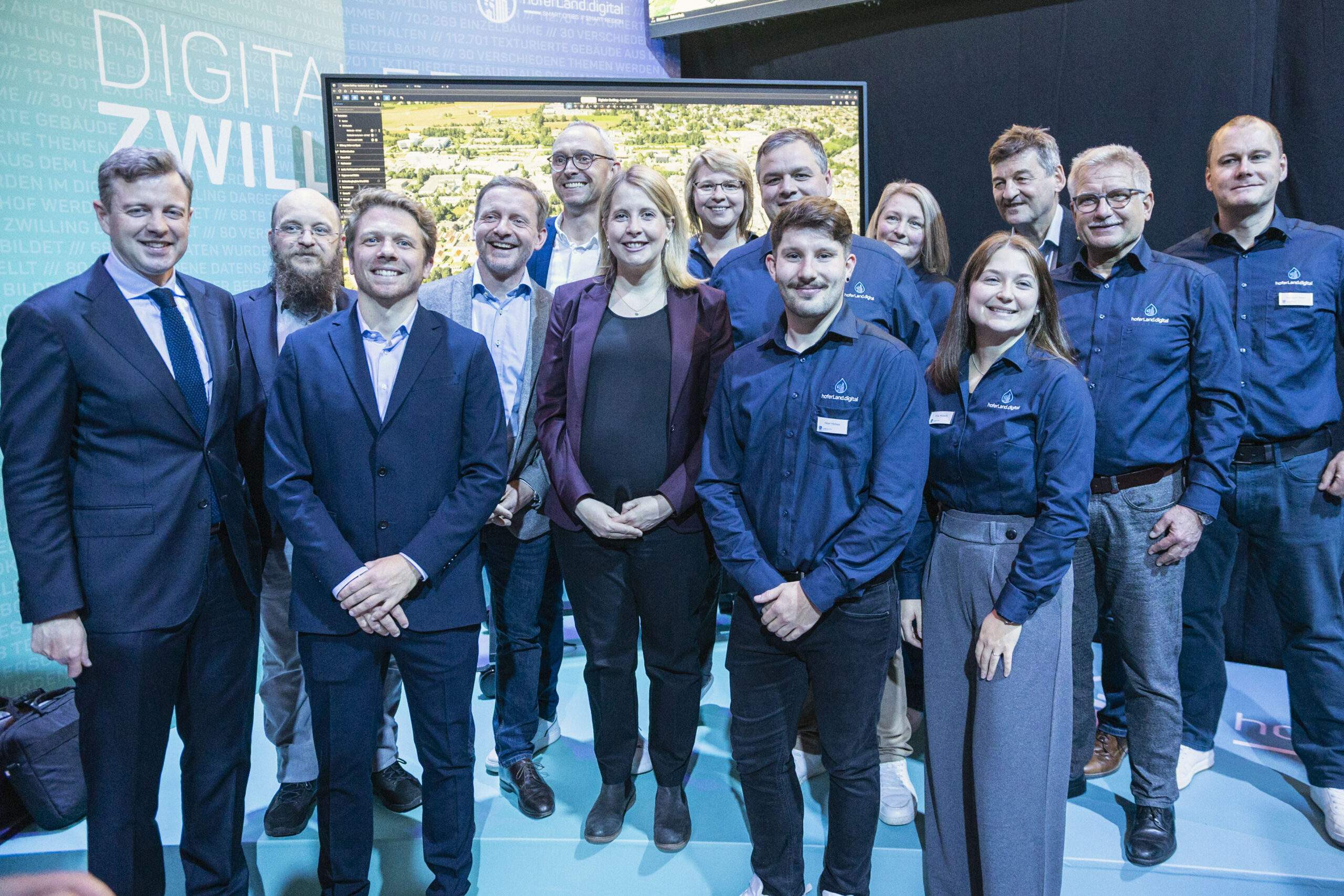
Figure 8: Federal Minister Verena Hubertz, project partners, and stakeholders celebrate the launch of the Smart City initiative InnovationsRAUM Hofer Land—a powerful signal for innovation and collaboration.