Digital TwinMobilityVC Map
City of Bremen links infra3D Viewer with the Digital Twin
High-resolution street image data for a 360° view of the urban landscape
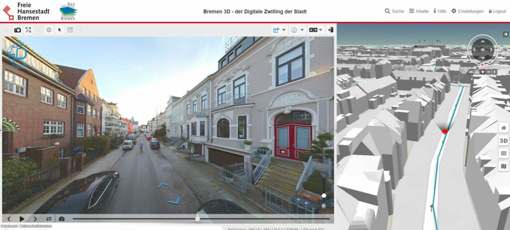
Bremen is expanding its Digital Twin by seamlessly integrating iNovitas’ infra3D Viewer with Virtual City Systems’ 3D city model solution. This integration offers interesting possibilities for the efficient use of already existing mobile mapping data and provides valuable insights for the city administration staff.
The high-resolution street image data, originally collected for road condition assessment, provides an impressive 360° view of the urban landscape. This not only enables detailed visualization of building facades, objects, and other street elements, but also facilitates seamless integration of geospatial data layers, including utility information, for improved analysis and asset management.
The digital street unlocks numerous applications and enhances the value of Bremen’s Digital Twin. City staff can now extract key information directly from the street environment, eliminating the need for a physical presence. For example, 90% of the parking meter inventory has already been captured on the digital street, reducing the number of on-site inspections. In addition, bicycle racks, benches, and billboards can be inventoried, and inquiries about electric charging stations can be answered online.


