New ReleaseVC SuiteWebinar
VC Suite | New Release 2025.1 available now
The new VC Suite 2025.1 release will be available to our customers from 29. August 2025. With this version, VC Map receives numerous new features and enhancements, and with VC Database 5.0 we are introducing the next generation of our database solution.
Explore the highlights of VC Suite 2025.1 and gain an early insight into the features of the upcoming release.
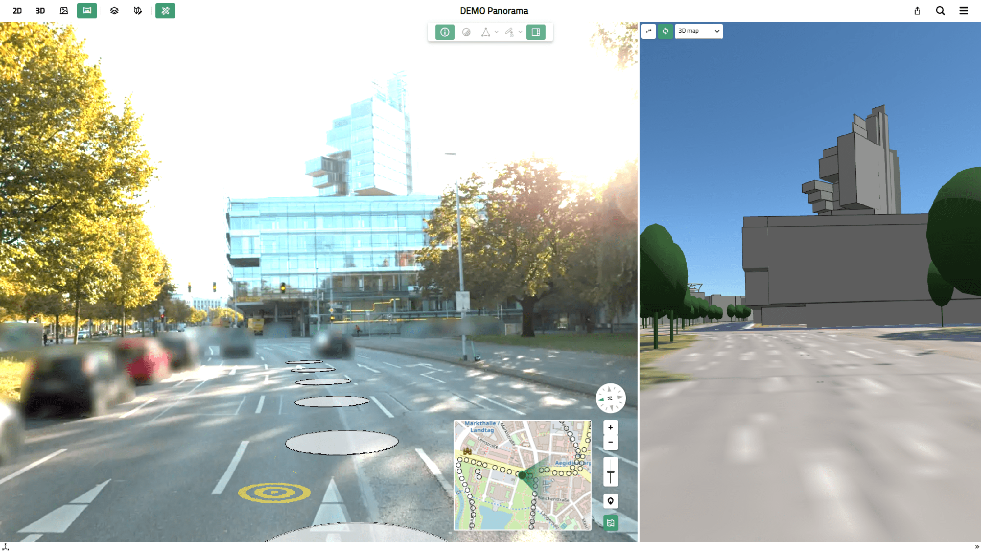
We are excited to introduce our new Panorama Viewer with VC Map 6.2. With just one click, you can now explore your 360° panorama images in VC Map – alongside 2D, 3D, and oblique aerial imagery. Intuitive navigation metaphors allow quick switching between panorama images captured at different locations. Based on an extension of the Multi View plugin it is possible to display an additional side map next to the main map showing 2D/3D content or oblique images synchronized with the panorama view. This opens many new opportunities to explore sites without an on-site visit.
Through an open interface, our Panorama Viewer supports mobile mapping data from different providers and camera systems. With upcoming releases, we will continue expanding its functionality. We are already working on 3D measurement tools as well as digitizing and integrating vector data – directly within panorama images. The Panorama Viewer is being developed on behalf of and in close collaboration with the City of Hanover and the City of Rostock.
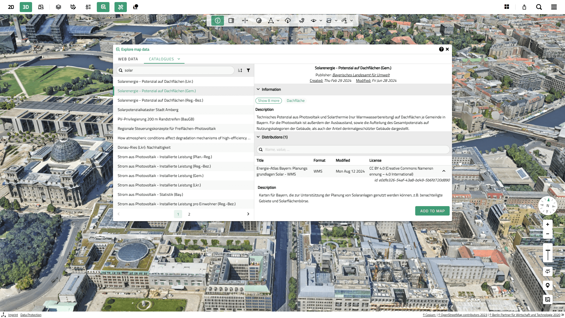
The new Dynamic Layer plugin in VC Map 6.2 lets you add and display geodata in a VC Map at runtime – without having to preconfigure it as a static map layer. This minimizes the number of predefined map contents while at the same time making VC Map more flexible for different (specialized) applications. Supported external data sources include OGC services (WMS, WMTS, WFS), 3D contents, point clouds, and terrain data.
A highlight: the Dynamic Layer plugin can be linked with common data catalogs such as GeoNetwork or Piveau. This allows direct catalog searches for relevant geodata within VC Map and seamless integration of results into the map. Connecting VC Map with central data catalogs is a key milestone for building integrated platforms for Urban Digital Twins.
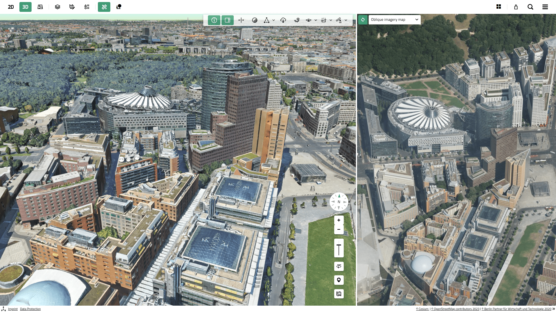
We have expanded the Multi View plugin into a true side map. It now works not only with oblique aerial imagery but with all map types. 2D, 3D, panorama, and oblique views can be combined with the main map and displayed in a secondary map view next to the main map. The side map is automatically synchronized but can also be explored independently. With a simple switch, you can change the content type for the side map or swap it with the main map. This new feature allows you to efficiently explore and compare data from multiple perspectives.
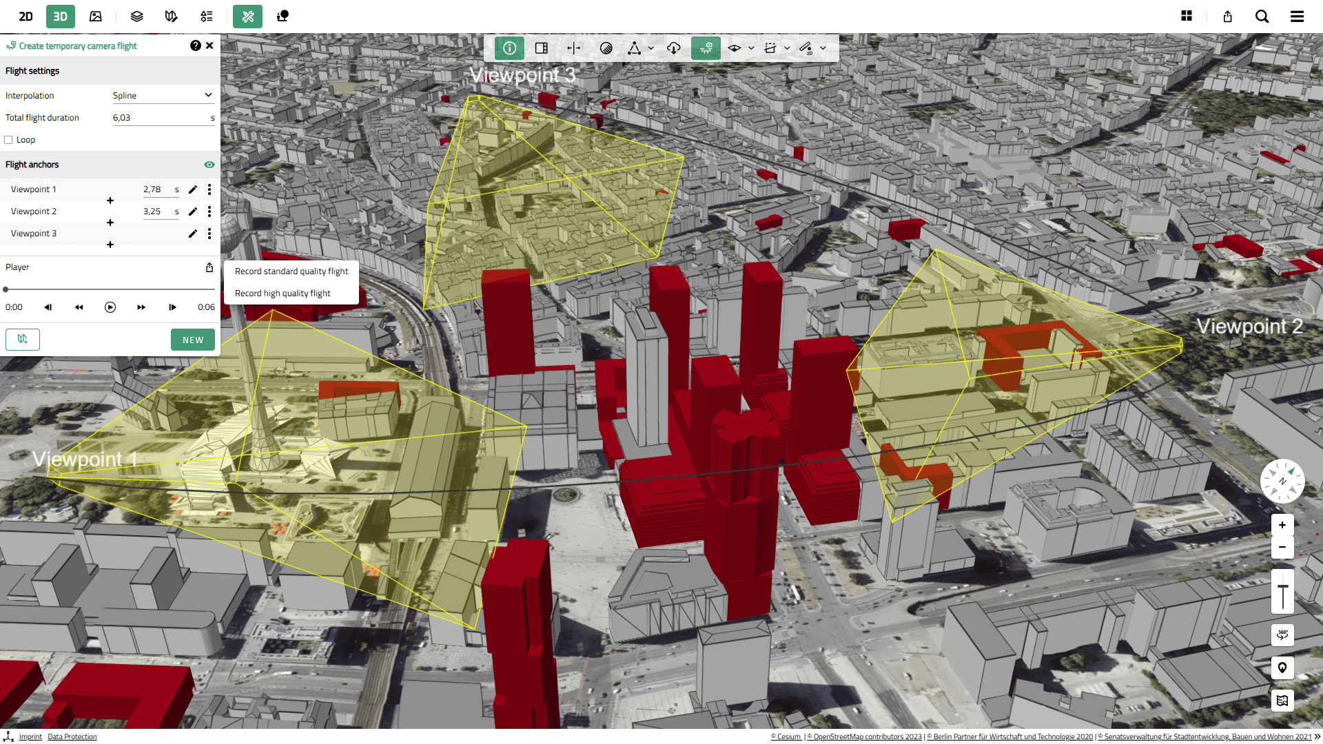
A long-standing request is now available: with VC Map 6.2, you can export camera flights directly as video files to your device. Video creation can be initiated from both standard VC Maps and in the VC Planner for your planning scenarios. Whether for documenting relevant 3D scenes or presenting planning and development projects—the new video function lets you do both at the push of a button.
We have migrated the VC Story Template for storytelling applications to our new VC Map 6 technology. You can now create and publish presentations and guided map applications with the modern VC Map 6 design. A VC Story can also be launched directly from a VC Map application at the push of a button, without leaving the application. All previous functionalities remain available, and migration of existing VC Stories is straightforward.
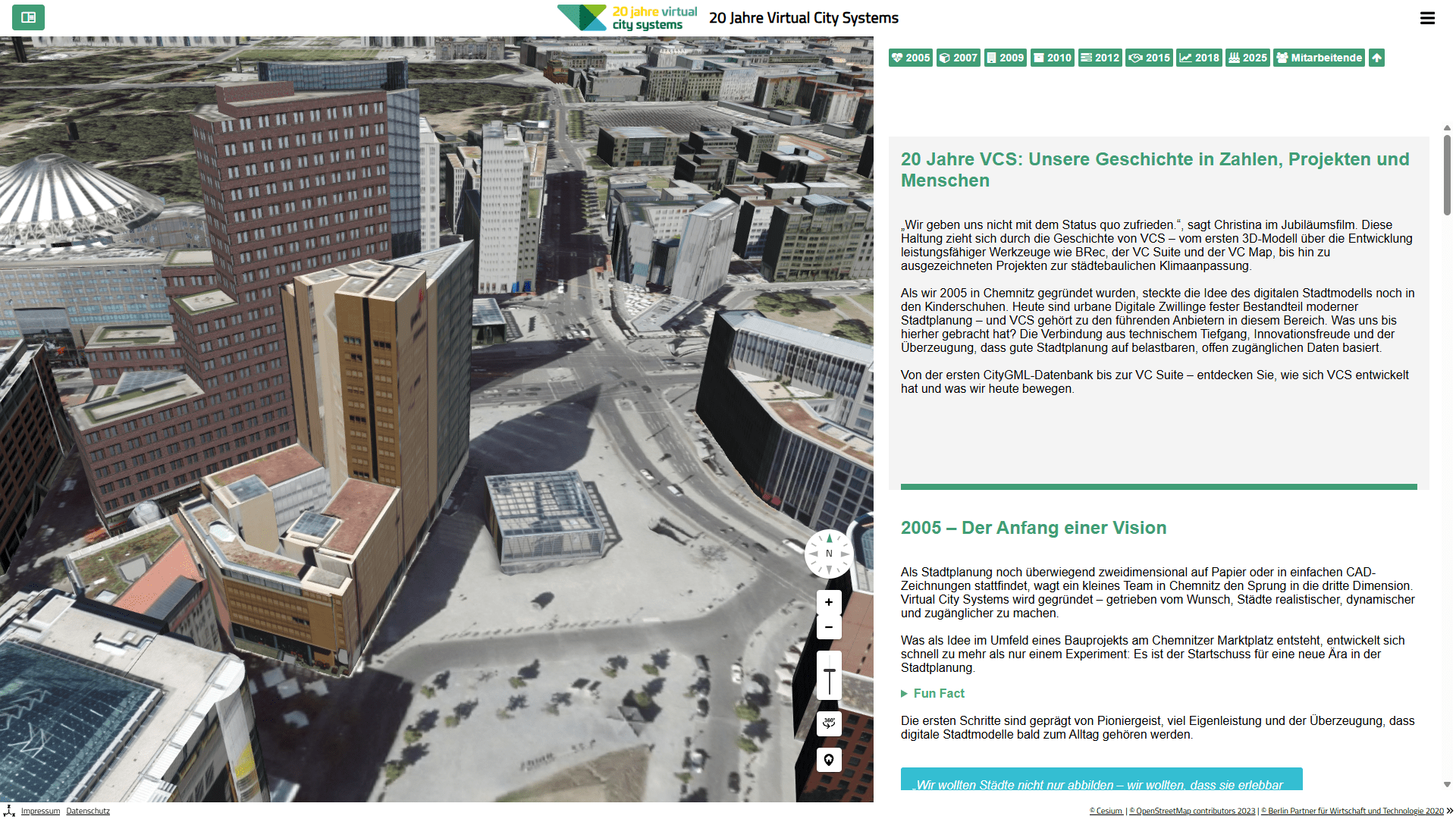
Have you seen our anniversary VC Story (in German), created to celebrate 20 years of VCS? Optimized for desktop, mobile view not recommended.
In complex map applications with many predefined layers – especially from WMS/WFS services – layers can easily overlap. Although layer order can be statically configured, this rarely covers all cases. With VC Map 6.2, users can now dynamically reorder supported map layers via drag & drop, bringing the relevant layer to the top and preventing visual conflicts.
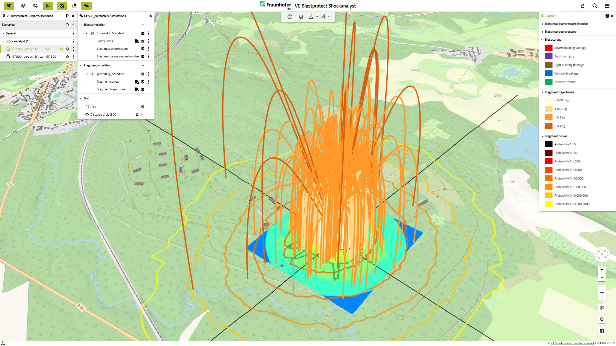
We have migrated our VC Blastprotect solution—used for 3D simulation of the propagation of blast pressure waves and the complex fragment trajectories of World War II aerial bombs—to VC Map 6. As a result, the user interface now features a completely redesigned, modern look.
Thanks to the expanded capabilities of VC Map 6, simulation scenarios can now be set up even more easily and intuitively, bomb sites and characteristics can be defined with precision, simulation results can be rendered realistically and informatively, and different scenarios can be compared with ease.
Read more about the Largest test series since World War II Live detonations of aerial bombs on our Blog.
This release introduces version 5.0 of VC Database, with full support for the OGC standards CityGML 3.0 and CityJSON 2.0. Previous versions of both standards continue to be supported without data loss. The VC Database 5.0 schema has been completely restructured and simplified, improving data management, GIS tool integration, and automated process workflows.
With CityGML 3.0 support, VC Database remains a core component for implementing Urban Digital Twins. It continues to be based on the open-source 3D City Database, which we actively co-develop as core contributors.
Note: Version 5.0 of VC Database carries a “Beta” label for a transition period to ensure safe and stable migration of existing data and processes. Beta testers can also request a preview version of the next VC Warehouse with VC Database 5.0 support.
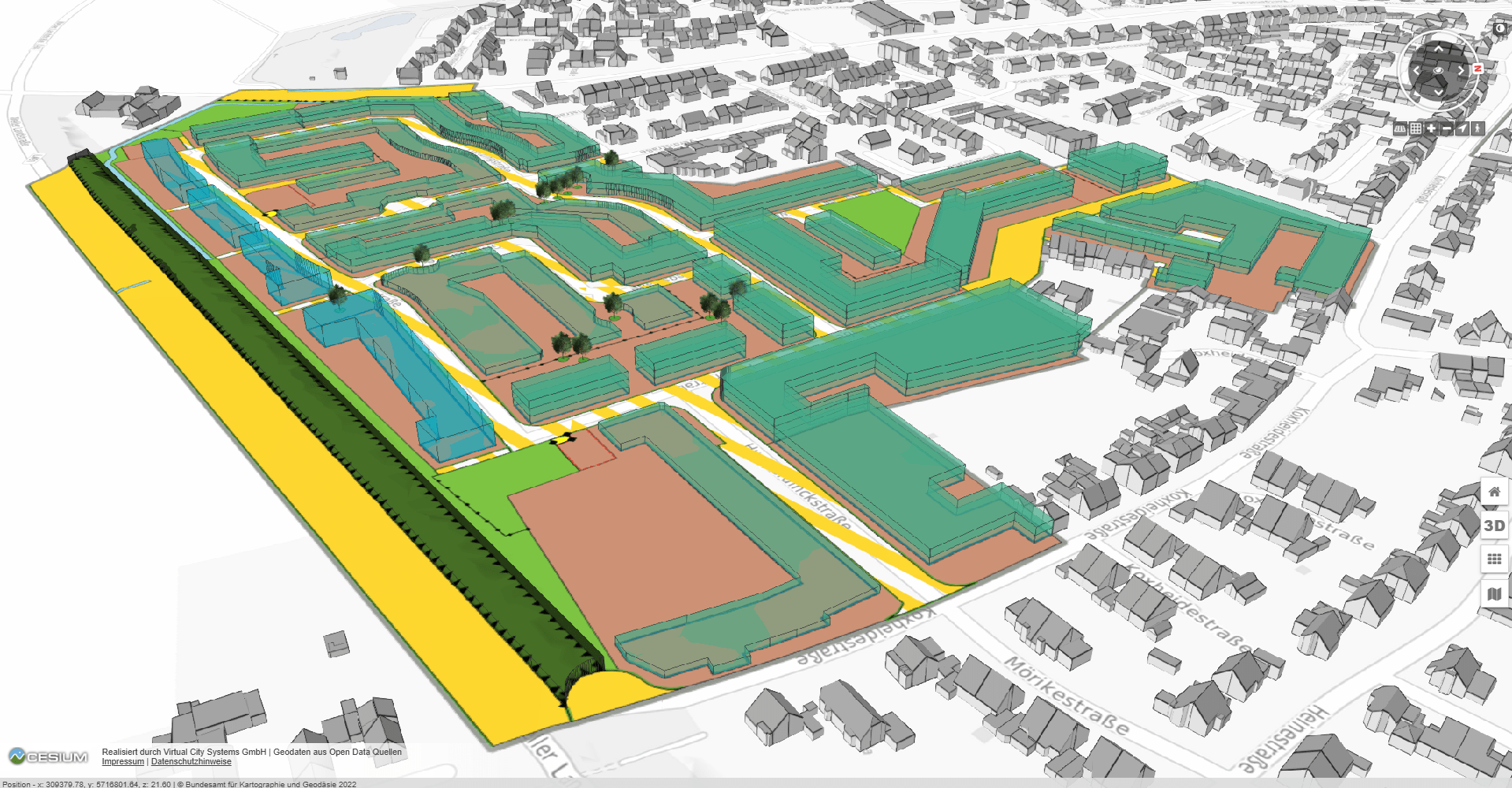
On behalf the District of Kleve, we are extending the VC Map with automatic 3D visualization of fully vectorized development plans in the German XPlanGML format. With the XPlan3D plugin, it will be possible to query relevant plans from the backend, dynamically integrate them into the VC Map application, download associated plan documents, and hide existing 3D buildings within the scope of the plans. With one click, 3D representations of all planned building plots can be derived from the 2D information and displayed on the map.
XPlan3D enables efficient analysis and clear communication of urban plans and their impacts. The 3D building plot representations are generated directly within VC Map – no preprocessing required.
This release focuses on VC Map, but we are already working intensively on the next version of VC Publisher 6 to modernize our backend and adapt it to new customer needs. A sneak preview is planned for this year’s user conference.
Our VC Map and most of the developments and extensions from this release are available as open source! Our VC Map Community page on GitHub is open to all customers and developers. The platform supports collaboration and knowledge exchange and provides an overview of free VC Map plugins contributed by the community.
- Support for Cloud Optimized GeoTIFFs: We have added a new layer type for integrating and displaying COGs in VC Map.
- Improved WMS GetFeatureInfo support: Different response formats of WMS GetFeatureInfo requests can now be integrated more flexibly into a FeatureInfo balloon for the VC Map.
- Secure iFrame embedding: If content in a FeatureInfo balloon is embedded via an iFrame, it now runs in a sandbox by default to avoid security exploits.
- Enhanced legend window: The legend window can now be configured to close automatically when the last legend-enabled layer is disabled in the content tree.
- Persistent search results: In earlier versions, closing the search window cleared the search results. This also happened when the window was closed by other tools and windows. Now search results remain available.
- Logos for dark mode: Special logos can now be defined for VC Map’s dark mode.
- Coordinate input for points: When drawing or editing points in VC Planner, coordinates can now be entered manually.
- Further improvements and bug fixes: Full details are available in the changelog for the open-source VC Map 6.2 on GitHub.