Digital TwinVC MapVC Planner
From Model to Future: How Etteln became the world’s smartest community with the help of its Digital Twin
What does it take for a small village to be named the best smart city in the world – even ahead of Hong Kong? In Etteln, the answer begins with a digital twin, open data, and genuine civic participation. Discover how geodata drives transformation – and how an entire community benefits.
How Etteln became the most digital village in the world – with the support of Virtual City Systems
Etteln, a district of the municipality of Borchen in North Rhine-Westphalia, was named the world’s best “Smart City” by the Institute of Electrical and Electronics Engineers (IEEE) in October 2024 – even ahead of the metropolis of Hong Kong. This recognition is rooted in a comprehensive digitalization strategy that integrates diverse technologies and applications. A core element of this strategy is the Digital Village Twin, implemented in 2023 with the support of Virtual City Systems (VCS) and the FIWARE Foundation.
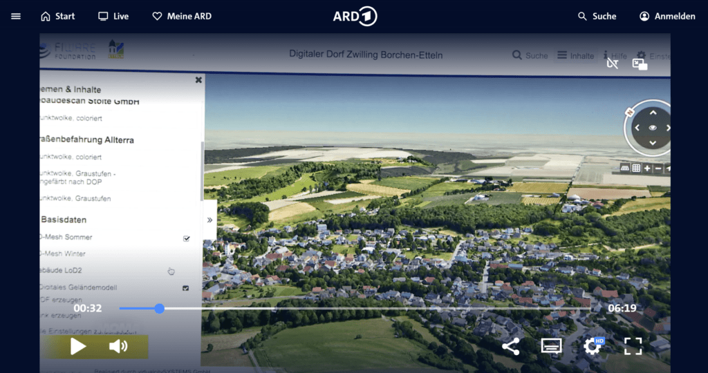
The visibility that came with this success did not go unnoticed – ARD Morgenmagazin featured Etteln in a broadcast highlighting the village’s pioneering role.
The Digital Village Twin: A cornerstone of Etteln’s digital transformation
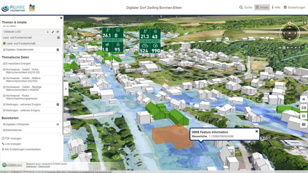
The interactive, web-based 3D model of Etteln is part of the Digital Village Twin. It integrates real-time data from various sensors, public services provided by the state of North Rhine-Westphalia related to flood and heavy rainfall risks, as well as scan data from streets and planning projects.
Its intuitive interface makes the platform accessible and efficient for administrators, specialist departments, and citizens alike – opening up new opportunities for forward-thinking municipal planning and meaningful public engagement. An article published by RedaktionsNetzwerk Deutschland showcases how this digital transformation is already reshaping life in Etteln.
Virtual City Systems’ Digital Twin as an integrative platform for Etteln’s smart solutions
The Digital Village Twin provides the technological backbone for a variety of smart initiatives in Etteln. It connects diverse applications and data sources through a central, open integration platform, establishing a consistent, scalable, and future-ready digital infrastructure. Key technological components provided by Virtual City Systems include:
- Textured 3D surface model (3D mesh): Serves as a core visual element in the VC Map, offering an accurate representation of Etteln’s real-world spatial structure.
- High-resolution point clouds: Derived from building scans and road surveys, these support detailed visualization, planning, and analysis.
- Integration of flood and heavy rainfall hazard maps (North Rhine-Westphalia): Offers a clear overview of potential risk areas and assists the municipality in planning climate adaptation measures.
- Sensor data: Real-time readings from local sensors – covering weather, air quality, and environmental conditions – are visualized via FIWARE-compliant standards, ensuring transparency and supporting data-driven decisions.
- Planning projects: The planned extension of Etteln’s community hall was visualized in the VC Map using the VC Planner, incorporating design proposals, variants, layouts, and renderings from the architectural firm Brockmeyer + Rüting GbR.
This combination provides not only a comprehensive understanding of Etteln’s physical environment, but also the foundation for intelligent, data-driven planning and communication – from infrastructure development to citizen engagement.