VC SuiteWebinar
Webinar in German | The VC Suite at a Glance – Your All-in-One Solution for 3D Geospatial Data Infrastructures
On Wednesday, May 28, 2025, from 11:00 AM to 12:00 PM (CET), this free webinar will focus on the VC Suite. Learn how to efficiently manage, analyze, and clearly visualize spatial data – without time-consuming technical obstacles.

In this webinar, you’ll gain a solid overview of the VC Suite – the modular platform by Virtual City Systems for digital twins and 3D geospatial data infrastructures in the municipal context.
You’ll get to know the key components and see how they seamlessly interact to support the successful implementation of complex geospatial data projects – from data management to web-based visualization.
At a glance:
✅VC Publisher – our powerful authoring tool for creating, editing, and publishing interactive 3D web maps. It enables intuitive content preparation and audience-specific presentation of spatial data – all without the need for programming.
✅VC Map – the core visualization module of the VC Suite: a high-performance, web-based 3D mapping application that allows users to interactively explore and analyze spatial content – on any device, directly in the browser.
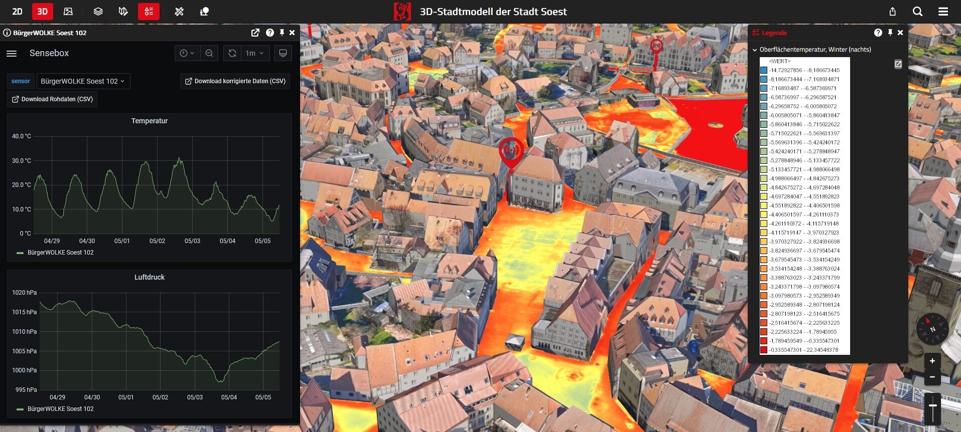
Screen: Climate simulation in VC Map – created with the VC Suite, using the example of the city of Soest.
© Virtual City Systems
✅VC Warehouse – facilitates the conversion and export of 3D city models into purpose-specific formats for further processing. Users can download models directly in the format best suited to their software environment – offering maximum flexibility.
✅VC Database – a high-performance, PostGIS-based geospatial database optimized for managing large and heterogeneous datasets. It supports powerful queries, advanced analyses, and integration with external systems.
Your presenter:
Tim Wendt, Head of Customer Support, Virtual City Systems
Date: Wednesday, May 28, 2025
Time: 11:00 AM – 12:00 PM (CET)
Language: German; an English-language session will follow in June.
Following the presentation, you’ll have the opportunity to ask your questions during the live Q&A. We look forward to connecting with you!