Digitaler ZwillingVC Map
Construction Site Overview in the Digital Twin: How Wiesbaden Demonstrates the Potential of Open Platforms
The Digital Twin of the City of Wiesbaden illustrates how urban data platforms can be further developed as open systems. Based on the VC Map, a construction site overview has been integrated that exemplifies how specialist applications can be independently connected to an Urban Digital Twin.
Construction sites are a part of everyday life in cities. They are essential for the maintenance, expansion and transformation of urban infrastructure. At the same time, they regularly pose challenges for citizens, public administration and emergency services. Whenever roads are closed, traffic routes change or construction schedules are adjusted, the demand for reliable, up-to-date and easy-to-understand information increases.
Digital tools can make a decisive contribution here. The City of Wiesbaden uses its Digital Twin to visualise construction site information spatially and make it centrally accessible. This highlights a use case that goes beyond the specific topic itself: the Urban Digital Twin as an open, extensible platform.
The Wiesbaden Digital Twin as a Shared Foundation
The Digital Twin of the City of Wiesbaden was developed jointly with Virtual City Systems on the basis of the VC Map. The aim of this collaboration was to create a digital foundation on which urban data can be brought together spatially, visualised and made usable in the long term.
From the outset, the focus was not on a single application, but on establishing a platform-based infrastructure. The Digital Twin was designed to grow alongside the city’s requirements – as a central element of digital urban development that connects different topics, data sources and administrative departments.
This approach provides the foundation for ensuring that the Digital Twin does not remain static, but can be continuously further developed.
Construction Site Overview in the Digital Twin: Further Development on an Existing Basis
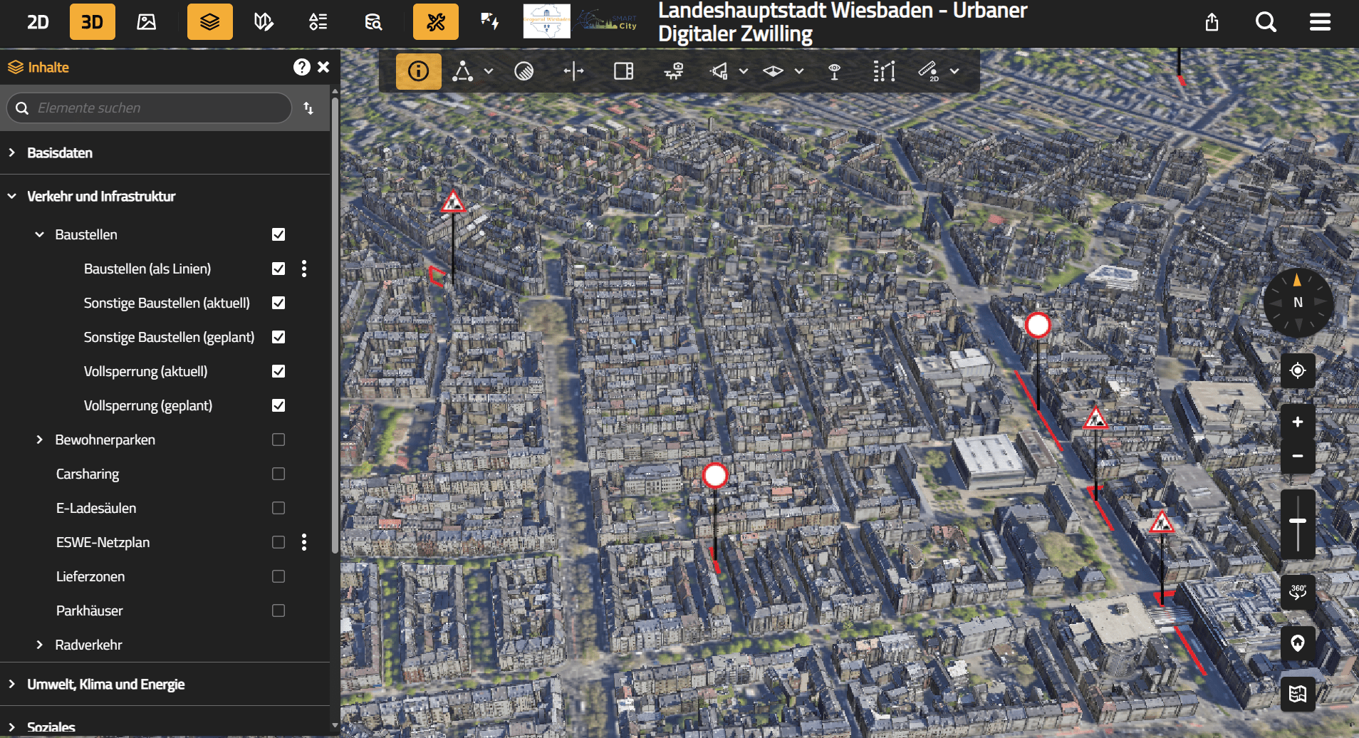
Building on this shared foundation, the City of Wiesbaden has continued to develop its Digital Twin in a consistent manner. A current example of this is the construction site overview, which is now available directly within the Digital Twin.
The application consolidates information on ongoing and planned construction sites and displays it spatially – exactly where it is relevant in the urban context. Specialist information that was previously often distributed across different channels is thus brought together in a shared digital space and visualised in a clear and comprehensible way.
Based on the VC Map implemented together with Virtual City Systems, Wiesbaden was able to independently extend and further differentiate the Digital Twin in terms of content. The construction site overview is therefore not an isolated individual project, but an expression of an overarching digital concept focused on openness, extensibility and long-term usability.
System of Systems: Why This Approach Works
The Wiesbaden example can be well described using the system-of-systems principle:
- The Digital Twin based on the VC Map forms the central core system.
- Specialist applications such as the construction site overview remain independent.
- Information is connected via open interfaces and displayed in a spatial context.
This loose coupling enables cities to integrate new topics, continue using existing systems and gradually expand their digital solutions. The result is a modular system landscape that can adapt to changing requirements.
This approach is particularly crucial for Urban Digital Twins, as they are not conceived as a single application, but as a long-term digital platform.
Added Value on Multiple Levels
Even though the construction site overview addresses a clearly defined topic, this example demonstrates the added value that integrated digital solutions can provide.
For citizens, construction site information is presented transparently, centrally and in a spatially intuitive way. This makes it easier to navigate the city and supports individual daily planning.
For public administration, the Digital Twin serves as a shared visual foundation for different types of specialist information. Media discontinuities are reduced, information is presented consistently and collaboration across departments is improved.
There is also potential for emergency services: for fire brigades, police and rescue services, an integrated overview of construction sites may become increasingly relevant in the future – for example for situational awareness, route planning or operational preparation. The Digital Twin provides a shared spatial basis on which additional information could be layered.
What Other Cities Can Learn from This
The construction site overview in the Wiesbaden Digital Twin is not an isolated case. Rather, it exemplifies how cities can use their Urban Digital Twins to make existing specialist applications visible and develop new services.
The decisive factor is not the individual topic, but the underlying architecture. Whether traffic, mobility, environment, climate or crisis management – added value is created wherever Digital Twins are understood as open, extensible platforms.
Cities that follow this path establish a digital infrastructure that is sustainable in the long term and enables independent further development.
The Role of Virtual City Systems
Virtual City Systems supports municipalities in building such digital foundations. With the VC Map, a platform is created that serves as a central entry point for urban data and remains open to specialist extensions.
The goal is not to implement every application directly. Instead, the key value lies in empowering cities to independently further develop their Digital Twins, integrate existing systems and unlock new use cases.
The Digital Twin of Wiesbaden demonstrates how this approach can work in practice.